Buell, Missouri | |
|---|---|
| Coordinates: 39°01′58″N 91°26′26″W / 39.03278°N 91.44056°W[1] | |
| Country | United States |
| State | Missouri |
| County | Montgomery |
| Area | |
| • Total | 0.09 sq mi (0.23 km2) |
| • Land | 0.09 sq mi (0.23 km2) |
| • Water | 0.00 sq mi (0.00 km2) |
| Elevation | 761 ft (232 m) |
| Population (2020) | |
| • Total | 25 |
| • Density | 284.09/sq mi (109.50/km2) |
| FIPS code | 29-09496 |
| GNIS feature ID | 2804676[1] |
Buell is an unincorporated community in northern Montgomery County, Missouri, United States.[3] It is located approximately five miles northeast of Montgomery City on Route 161.
Buell was platted in 1903, and named after Buell Hensley, a local businessman.[4] A post office called Buell was established in 1904, and remained in operation until 1978.[5]
Demographics
| Census | Pop. | Note | %± |
|---|---|---|---|
| 2020 | 25 | — | |
| U.S. Decennial Census[6] | |||
References
- 1 2 3 U.S. Geological Survey Geographic Names Information System: Buell, Missouri
- ↑ "ArcGIS REST Services Directory". United States Census Bureau. Retrieved September 5, 2022.
- ↑ U.S. Geological Survey Geographic Names Information System: Buell, Missouri
- ↑ "Montgomery County Place Names, 1928–1945". The State Historical Society of Missouri. Archived from the original on June 24, 2016. Retrieved November 11, 2016.
- ↑ "Post Offices". Jim Forte Postal History. Retrieved November 11, 2016.
- ↑ "Census of Population and Housing". Census.gov. Retrieved June 4, 2016.
Municipalities and communities of Montgomery County, Missouri, United States | ||
|---|---|---|
| Cities | 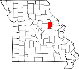 Map of Missouri highlighting Montgomery County | |
| Village | ||
| Townships | ||
| CDPs | ||
| Other communities | ||
This article is issued from Wikipedia. The text is licensed under Creative Commons - Attribution - Sharealike. Additional terms may apply for the media files.