Buritama | |
|---|---|
 | |
 Flag  Coat of arms | |
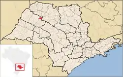 Location in São Paulo state | |
 Buritama Location in Brazil | |
| Coordinates: 21°4′0″S 50°8′51″W / 21.06667°S 50.14750°W | |
| Country | Brazil |
| Region | Southeast |
| State | São Paulo |
| Area | |
| • Total | 327 km2 (126 sq mi) |
| Population (2020 [1]) | |
| • Total | 17,281 |
| • Density | 53/km2 (140/sq mi) |
| Time zone | UTC−3 (BRT) |
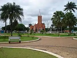
Buritama is a municipality in the state of São Paulo in Brazil. The population is 17,281 (2020 est.) in an area of 327 km².[2]
References
This article is issued from Wikipedia. The text is licensed under Creative Commons - Attribution - Sharealike. Additional terms may apply for the media files.