Caconde | |
|---|---|
 | |
 Flag  Coat of arms | |
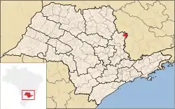 Location in São Paulo state | |
 Caconde Location in Brazil | |
| Coordinates: 21°31′44″S 46°38′38″W / 21.52889°S 46.64389°W | |
| Country | Brazil |
| Region | Southeast |
| State | São Paulo |
| Area | |
| • Total | 468 km2 (181 sq mi) |
| Elevation | 860 m (2,820 ft) |
| Population (2020 [1]) | |
| • Total | 19,009 |
| • Density | 41/km2 (110/sq mi) |
| Time zone | UTC−3 (BRT) |
| Postal code | 13770-000 |
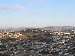
Caconde is a municipality in the state of São Paulo in Brazil. The population is 19,009 (2020 est.) in an area of 468 km².[2]
References
External links
 Caconde travel guide from Wikivoyage
- Caconde Brazil
- Touristic Information
This article is issued from Wikipedia. The text is licensed under Creative Commons - Attribution - Sharealike. Additional terms may apply for the media files.