Canoe Lake 165A | |
|---|---|
| Canoe Lake Indian Reserve No. 165A | |
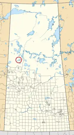 Location in Saskatchewan | |
| First Nation | Canoe Lake |
| Country | Canada |
| Province | Saskatchewan |
| Area | |
| • Total | 1,158.3 ha (2,862.2 acres) |
Canoe Lake 165A is an Indian reserve of the Canoe Lake Cree First Nation in Saskatchewan.[1][2] It is 30 miles southwest of Île-à-la-Crosse.
See also
References
- 1 2 "Reserve/Settlement/Village Detail". Crown–Indigenous Relations and Northern Affairs Canada. Government of Canada. Retrieved 12 August 2019.
- ↑ "Canada Lands Survey System - CLSS Map Browser". Natural Resources Canada. Retrieved 9 October 2019.

55°09′26″N 108°23′13″W / 55.1573°N 108.387°W
This article is issued from Wikipedia. The text is licensed under Creative Commons - Attribution - Sharealike. Additional terms may apply for the media files.