Carbondale Township | |
|---|---|
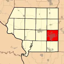 Location in Jackson County | |
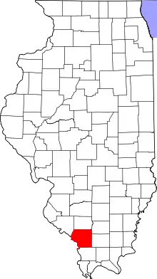 Jackson County's location in Illinois | |
| Coordinates: 37°43′48″N 89°12′35″W / 37.73000°N 89.20972°W | |
| Country | United States |
| State | Illinois |
| County | Jackson |
| Established | November 4, 1884 |
| Area | |
| • Total | 38.17 sq mi (98.9 km2) |
| • Land | 37.41 sq mi (96.9 km2) |
| • Water | 0.76 sq mi (2.0 km2) 1.99% |
| Elevation | 400 ft (122 m) |
| Population (2010) | |
| • Estimate (2016)[1] | 29,181 |
| • Density | 789.7/sq mi (304.9/km2) |
| Time zone | UTC-6 (CST) |
| • Summer (DST) | UTC-5 (CDT) |
| ZIP codes | 62901, 62966 |
| FIPS code | 17-077-11170 |
Carbondale Township is one of sixteen townships in Jackson County, Illinois, USA. As of the 2010 census, its population was 29,544 and it contained 14,341 housing units.[2] Southern Illinois University is located in this township.
Geography
According to the 2010 census, the township has a total area of 38.17 square miles (98.9 km2), of which 37.41 square miles (96.9 km2) (or 98.01%) is land and 0.76 square miles (2.0 km2) (or 1.99%) is water.[2]
Cities, towns, villages
- Carbondale (vast majority)
Unincorporated towns
- Evergreen Terrace at 37°41′57″N 89°14′08″W / 37.699217°N 89.23564°W
- Southern Hills at 37°42′14″N 89°12′38″W / 37.703939°N 89.210639°W
(This list is based on USGS data and may include former settlements.)
Adjacent townships
- De Soto Township (north)
- Makanda Township (south)
- Pomona Township (southwest)
- Murphysboro Township (west)
- Somerset Township (northwest)
Cemeteries
The township contains these six cemeteries: Dillinger, North County Line, Oakland, Snider Hill, Winchester and Woodlawn.
Major highways
Airports and landing strips
- Memorial Hospital of Carbondale Heliport
- Southern Illinois Airport (southeast quarter)
Lakes
- Campus Lake
Landmarks
- Attucks Park
- Evergreen Park
- The Crossings
- University Mall
Demographics
| Census | Pop. | Note | %± |
|---|---|---|---|
| 2016 (est.) | 29,181 | [1] | |
| U.S. Decennial Census[3] | |||
School districts
- Murphysboro Community Unit School District 186
Political districts
- Illinois' 12th congressional district
- State House District 115
- State Senate District 58
References
- "Carbondale Township, Jackson County, Illinois". Geographic Names Information System. United States Geological Survey, United States Department of the Interior. Retrieved January 17, 2010.
- United States Census Bureau 2007 TIGER/Line Shapefiles
- United States National Atlas
- 1 2 "Population and Housing Unit Estimates". Retrieved June 9, 2017.
- 1 2 "Population, Housing Units, Area, and Density: 2010 - County -- County Subdivision and Place -- 2010 Census Summary File 1". United States Census. Archived from the original on February 12, 2020. Retrieved May 28, 2013.
- ↑ "Census of Population and Housing". Census.gov. Retrieved June 4, 2016.
External links
Municipalities and communities of Jackson County, Illinois, United States | ||
|---|---|---|
| Cities | Map of Illinois highlighting Jackson County | |
| Villages | ||
| Townships | ||
| CDP | ||
| Other unincorporated communities | ||
| Ghost town | ||
| Footnotes | ‡This populated place also has portions in an adjacent county or counties | |
This article is issued from Wikipedia. The text is licensed under Creative Commons - Attribution - Sharealike. Additional terms may apply for the media files.