| Carters Brook | |
|---|---|
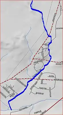 Carters Brook map | |
| Location | |
| Country | United States |
| Physical characteristics | |
| Source | |
| • coordinates | 40°24′23″N 74°35′43″W / 40.40639°N 74.59528°W |
| Mouth | |
• coordinates | 40°22′14″N 74°36′9″W / 40.37056°N 74.60250°W |
• elevation | 66 ft (20 m) |
| Basin features | |
| Progression | Heathcote Brook, Millstone River, Raritan River, Atlantic Ocean |
Carters Brook, also known as Carter Brook, is a branch of the Heathcote Brook in Somerset and Middlesex counties, New Jersey in the United States.
Course
The Carters Brook source is at 40°24′23″N 74°35′43″W / 40.40639°N 74.59528°W,[1] near the intersection of Route 518 and Route 27. It flows generally south, crossing Promenade Boulevard and Raymond Road before draining into the Heathcote Brook at 40°22′14″N 74°36′9″W / 40.37056°N 74.60250°W.[1]
Accessibility
The Carters Brook is accessible by several roads.
Sister tributary
See also
References
- 1 2 "GNIS Detail - Carters Brook". USGS. Retrieved 3 July 2010.
External links
This article is issued from Wikipedia. The text is licensed under Creative Commons - Attribution - Sharealike. Additional terms may apply for the media files.