| Chappal Waddi | |
|---|---|
 | |
| Highest point | |
| Elevation | 2,419 m (7,936 ft)[1] |
| Prominence | 1,157 m (3,796 ft) |
| Listing | Country high point |
| Coordinates | 07°02′10″N 11°42′54″E / 7.03611°N 11.71500°E |
| Geography | |
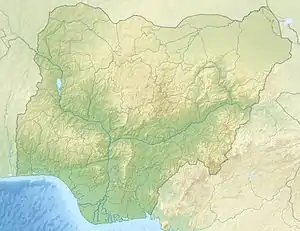 Chappal Waddi Location of Chappal Waddi (Gang) in Nigeria (on border with Cameroon) | |
| Location | Nigeria / Cameroon |
Chabbal Waddi (also known as the Mountain of Death) is located in Nigeria and, at 2,419 m (7,936 ft), is the country's highest point.[2] It is located in Taraba State, near the border with Cameroon, on the edge of the Gashaka Gumti Forest Reserve and the Gashaka-Gumti National Park on the Mambilla Plateau.[3] It is a part of the Bamenda-Alantika-Mandara Mountain chain of Nigeria and Cameroon.[4]
Gallery
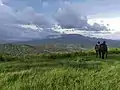 Chappal Wadi, the second-highest point in sub-saharan West Africa after Mount Cameroon and Emi Koussi
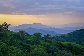 Dusk in a remote section of Gashaka-Gumti National Park
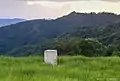 Boundary along the Nigerian-Cameroon border in Gashaka-Gumti National Park
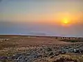 Sunset on Chappal Waddi
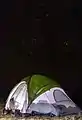 Camping on Chappal Waddi
References
- ↑ "Chappal Waddi - Peakbagger.com". www.peakbagger.com. Retrieved 28 May 2023.
- ↑ "Nigeria Physical Map". Free World Maps – Atlas of the World. Retrieved 28 May 2023.
- ↑ http://www.nigeria-direct.com/activity/climb-nigeria's-highest-mountain-Gang or chappal-waddi
- ↑ "Gang or Chappal Waddi: The Country's Highest Point". www.gloomme.com. Retrieved 11 May 2022.
This article is issued from Wikipedia. The text is licensed under Creative Commons - Attribution - Sharealike. Additional terms may apply for the media files.