| Chirip | |
|---|---|
 | |
| Highest point | |
| Elevation | 1,587 m (5,207 ft)[1] |
| Prominence | ± 5043 |
| Coordinates | 45°20′17″N 147°55′30″E / 45.338°N 147.925°E |
| Geography | |
 Chirip Chirip in Russian Far East | |
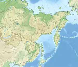
| Location | Iturup, Kuril Islands, Russia |
| Geology | |
| Mountain type | Stratovolcanoes |
| Last eruption | 1860 (?) |
| Climbing | |
| Easiest route | east slope (?) |
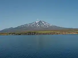
Chirip (Russian: Чирип, Japanese: 北散布山) is a volcano located in the central part of Iturup Island, Kuril Islands, Russia. In lies on the Chirip Peninsula and comprises two twin stratovolcanoes, Chirip and Bogdan Hmelnitskiy.[2] The western side is the steepest, sharing a basin, with a small lake with Bogdan Hmelnitskiy. Basin has features that were created during an eruption. Many types of lava found are basalt, and andesite, small amounts of dacite found.[3]
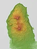
Relief map
Notes
- ↑ Chirip PeakVisor
- ↑ Bogdan Hmelnitskiy PeakVisor
- ↑ "Global Volcanism Program | Chirippusan]] [Chirip]".
See also
References
This article is issued from Wikipedia. The text is licensed under Creative Commons - Attribution - Sharealike. Additional terms may apply for the media files.