Chiuro
| |
|---|---|
| Comune di Chiuro | |
Location of Chiuro | |
 Chiuro Location of Chiuro in Italy 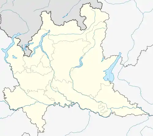 Chiuro Chiuro (Lombardy) | |
| Coordinates: 46°10′N 9°59′E / 46.167°N 9.983°E | |
| Country | Italy |
| Region | Lombardy |
| Province | Province of Sondrio (SO) |
| Frazioni | Castionetto, Casacce |
| Area | |
| • Total | 51.8 km2 (20.0 sq mi) |
| Elevation | 390 m (1,280 ft) |
| Population (Dec. 2004)[2] | |
| • Total | 2,499 |
| • Density | 48/km2 (120/sq mi) |
| Demonym | Chiuraschi |
| Time zone | UTC+1 (CET) |
| • Summer (DST) | UTC+2 (CEST) |
| Postal code | 23030 |
| Dialing code | 0342 |
| Website | Official website |
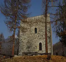
the medieval tower
Chiuro (Lombard: Ciür) is a comune (municipality) in the Province of Sondrio in the Italian region of Lombardy, located about 100 kilometres (62 mi) northeast of Milan and about 9 kilometres (6 mi) east of Sondrio, on the border with Switzerland. As of 31 December 2004, it had a population of 2,499 and an area of 51.8 square kilometres (20.0 sq mi).[3]
The municipality of Chiuro contains the frazioni (subdivisions, mainly villages and hamlets) Castionetto and Casacce.
Chiuro borders the following municipalities: Brusio (Switzerland), Castello dell'Acqua, Lanzada, Montagna in Valtellina, Ponte in Valtellina, Poschiavo (Switzerland), Teglio.
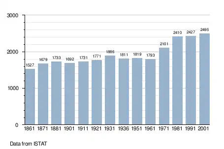
Demographic evolution
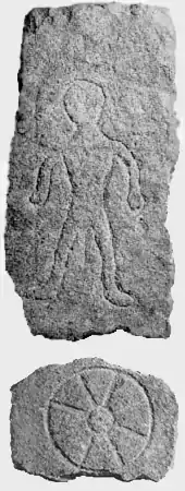
prehistoric finds in chiuro
References
- ↑ "Superficie di Comuni Province e Regioni italiane al 9 ottobre 2011". Italian National Institute of Statistics. Retrieved 16 March 2019.
- ↑ "Popolazione Residente al 1° Gennaio 2018". Italian National Institute of Statistics. Retrieved 16 March 2019.
- ↑ All demographics and other statistics: Italian statistical institute Istat.
External links
This article is issued from Wikipedia. The text is licensed under Creative Commons - Attribution - Sharealike. Additional terms may apply for the media files.