Clarkson is an unincorporated community in Howard County, Maryland, United States. A postal office operated in the community from September 14, 1889, to October 31, 1931.[1][2][3] Clarkson was the site of strategic simulations by the U.S. Army in 1922 training manuals.[4]
See also
References
- ↑ "Checklist of Maryland Post Offices" (PDF). Smithsonian National Postal Museum. July 12, 2007. Archived from the original (PDF) on May 18, 2014. Retrieved May 17, 2014.
- ↑ J. Onwhyn (1909). The Lancet, Volume 2, Part 1.
- ↑ Rand McNally International Bankers Directory. 1911. p. 1259.
- ↑ Tactical and Strategical Studies: Corps and Army. United States. General Service Schools. Fort Leavenworth. Kan.
- ↑ "Clarkson, Maryland Latitude/Longitude". Lat-Long.com. Retrieved August 19, 2014.
Municipalities and communities of Howard County, Maryland, United States | ||
|---|---|---|
| CDPs | 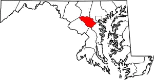 | |
| Villages | ||
| Unincorporated communities |
| |
| Ghost town | ||
| Footnotes | ‡This populated place also has portions in an adjacent county or counties | |
This article is issued from Wikipedia. The text is licensed under Creative Commons - Attribution - Sharealike. Additional terms may apply for the media files.