Clay Springs, Arizona | |
|---|---|
Census-designated place (CDP) | |
 | |
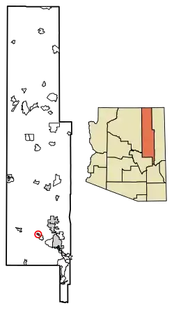 Location of Clay Springs in Navajo County, Arizona. | |
 Clay Springs, Arizona  Clay Springs, Arizona | |
| Coordinates: 34°21′42″N 110°17′43″W / 34.36167°N 110.29528°W | |
| Country | |
| State | |
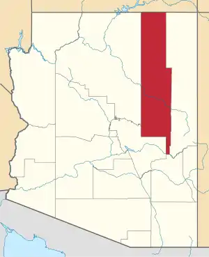
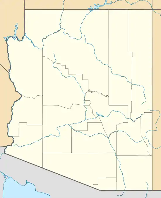
| County | Navajo |
| Area | |
| • Total | 2.85 sq mi (7.37 km2) |
| • Land | 2.85 sq mi (7.37 km2) |
| • Water | 0.00 sq mi (0.00 km2) |
| Elevation | 6,303 ft (1,921 m) |
| Population (2020) | |
| • Total | 331 |
| • Density | 116.30/sq mi (44.90/km2) |
| Time zone | UTC-7 (Mountain (MST)) |
| ZIP code | 85923 |
| Area code | 928 |
| FIPS code | 04-00 |
| GNIS ID(s) | 2582759[2] |
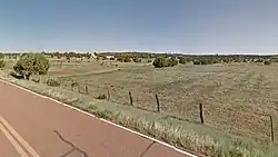
Clay Springs is a census-designated place (CDP) in Navajo County, Arizona, United States. Clay Springs is 16 miles (26 km) northwest of Show Low. Clay Springs has a post office with ZIP code 85923.[3]
Demographics
| Census | Pop. | Note | %± |
|---|---|---|---|
| 2020 | 331 | — | |
| U.S. Decennial Census[4] | |||
As of the census[5] of 2010, there were 401 people, 124 households, and 91 families residing in the CDP.
Climate
According to the Köppen Climate Classification system, Clay Springs has a cool-summer Mediterranean climate, abbreviated Csb on climate maps. Winters are very cold at night and cool to cold during the day, with on average 3.7 nights below 0 °F or −17.8 °C and 171.1 nights below 32 °F or 0 °C. April to June warms up and is generally the driest part of the year before monsoon storms hit between July and mid-September. Typically 17 days will hit 90 °F or 32.2 °C, but minima are generally not above 68 °F or 20 °C due to the altitude.
| Climate data for Clay Springs, Arizona (1971-1987) | |||||||||||||
|---|---|---|---|---|---|---|---|---|---|---|---|---|---|
| Month | Jan | Feb | Mar | Apr | May | Jun | Jul | Aug | Sep | Oct | Nov | Dec | Year |
| Record high °F (°C) | 68 (20) |
72 (22) |
74 (23) |
82 (28) |
90 (32) |
100 (38) |
97 (36) |
95 (35) |
90 (32) |
89 (32) |
78 (26) |
68 (20) |
100 (38) |
| Mean daily maximum °F (°C) | 45.3 (7.4) |
50.0 (10.0) |
54.9 (12.7) |
64.2 (17.9) |
72.2 (22.3) |
83.7 (28.7) |
86.3 (30.2) |
83.4 (28.6) |
77.2 (25.1) |
67.3 (19.6) |
55.2 (12.9) |
47.7 (8.7) |
65.6 (18.7) |
| Mean daily minimum °F (°C) | 18.7 (−7.4) |
20.8 (−6.2) |
26.4 (−3.1) |
30.5 (−0.8) |
37.1 (2.8) |
47.3 (8.5) |
54.5 (12.5) |
54.1 (12.3) |
46.1 (7.8) |
35.4 (1.9) |
25.7 (−3.5) |
19.1 (−7.2) |
34.6 (1.4) |
| Record low °F (°C) | −17 (−27) |
−15 (−26) |
−2 (−19) |
11 (−12) |
13 (−11) |
28 (−2) |
34 (1) |
40 (4) |
26 (−3) |
10 (−12) |
−21 (−29) |
−22 (−30) |
−22 (−30) |
| Average precipitation inches (mm) | 1.33 (34) |
1.35 (34) |
1.91 (49) |
0.58 (15) |
0.94 (24) |
0.31 (7.9) |
2.30 (58) |
2.33 (59) |
2.07 (53) |
1.61 (41) |
1.65 (42) |
1.47 (37) |
17.85 (453.9) |
| Average precipitation days (≥ 0.01 inch) | 6 | 5 | 8 | 4 | 4 | 2 | 9 | 9 | 6 | 4 | 5 | 5 | 67 |
| Source: Western Regional Climate Center[6] | |||||||||||||
Transportation
Mountain Valley Shuttle stops in Clay Springs on its Phoenix-Show Low route.[7]
References
- ↑ "2020 U.S. Gazetteer Files". United States Census Bureau. Retrieved October 29, 2021.
- 1 2 U.S. Geological Survey Geographic Names Information System: Clay Springs, Arizona
- ↑ ZIP Code Lookup
- ↑ "Census of Population and Housing". Census.gov. Retrieved June 4, 2016.
- ↑ "American FactFinder". United States Census Bureau. Archived from the original on February 13, 2020. Retrieved October 10, 2018.
- ↑ "Clay Springs, Arizona (021760) – Period of Record Monthly Climate Summary". Western Regional Climate Center. 2012. Retrieved on May 11, 2015.
- ↑ "Route Schedule/Stops". Archived from the original on January 27, 2020. Retrieved January 27, 2020.