| Cowskin Creek | |
|---|---|
 | |
| Location | |
| Country | United States |
| State | Missouri |
| Region | Douglas and Webster counties |
| Physical characteristics | |
| Source | |
| • coordinates | 37°05′31″N 92°41′48″W / 37.09194°N 92.69667°W[1] |
| • elevation | Approximately 1,400 ft (430 m)[2] |
| Mouth | |
• coordinates | 36°56′19″N 92°44′31″W / 36.93861°N 92.74194°W |
• elevation | 1,040 ft (320 m)[1] |
| Basin features | |
| Tributaries | |
| • left | Casto Creek, Prairie Creek |
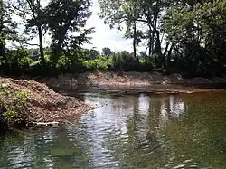
Cowskin Creek is a stream in northwest Douglas and extreme southeastern Webster counties of Missouri.[1] Cowskin has its headwaters in southeast Webster County west of Cedar Gap and is a tributary to Beaver Creek which it joins just west of the Arno store. The stream is bridged by Missouri Route 14 just east of the junction with Missouri Route K.[3]
According to tradition, a pioneer citizen skinned cows who had died of disease near this creek.[4]
See also
References
- 1 2 3 U.S. Geological Survey Geographic Names Information System: Cowskin Creek
- ↑ Cedar Gap, MO, 7.5 Minute Topographic Quadrangle, USGS, 1951 (1977 rev.)
- ↑ Missouri Atlas & Gazetteer, DeLorme, 1998, First edition, p.63, ISBN 0-89933-224-2
- ↑ "Douglas County Place Names, 1928–1945 (archived)". The State Historical Society of Missouri. Archived from the original on 24 June 2016. Retrieved 28 September 2016.
{{cite web}}: CS1 maint: bot: original URL status unknown (link)
This article is issued from Wikipedia. The text is licensed under Creative Commons - Attribution - Sharealike. Additional terms may apply for the media files.