Cujubim | |
|---|---|
 Flag  Coat of arms | |
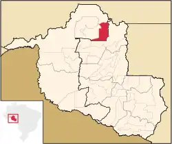 Location in Rondônia state | |
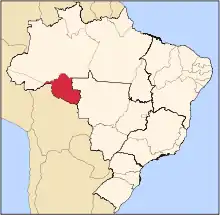
 Cujubim Location in Brazil | |
| Coordinates: 9°21′46″S 62°35′7″W / 9.36278°S 62.58528°W | |
| Country | Brazil |
| Region | North |
| State | Rondônia |
| Area | |
| • Total | 3,864 km2 (1,492 sq mi) |
| Population (2020 [1]) | |
| • Total | 26,183 |
| • Density | 6.8/km2 (18/sq mi) |
| Time zone | UTC−4 (AMT) |
Cujubim is a municipality located in the Brazilian state of Rondônia. Its population was 26,183 (2020) and its area is 3,864 km².[2]
The municipality contains 22% of the Angelim Extractive Reserve and 21% of the Ipê Extractive Reserve.[3][4] It contains the 660 hectares (1,600 acres) Tucano Sustainable Yield State Forest, created in 1996.[5]
References
- ↑ IBGE 2020
- ↑ IBGE -
- ↑ RESEX Angelim (in Portuguese), ISA: Instituto Socioambiental, retrieved 2016-08-30
- ↑ RESEX Ipê (in Portuguese), ISA: Instituto Socioambiental, retrieved 2016-08-31
- ↑ FLORSU Tucano (in Portuguese), ISA: Instituto Socioambiental, retrieved 2016-10-13
Capital: Porto Velho | ||||||||
| Porto Velho |
|  | ||||||
| Ji-Paraná |
| |||||||
This article is issued from Wikipedia. The text is licensed under Creative Commons - Attribution - Sharealike. Additional terms may apply for the media files.