Demirköy District | |
|---|---|
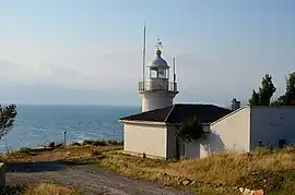 Limanköy Lighthouse | |
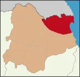 Map showing Demirköy District in Kırklareli Province | |
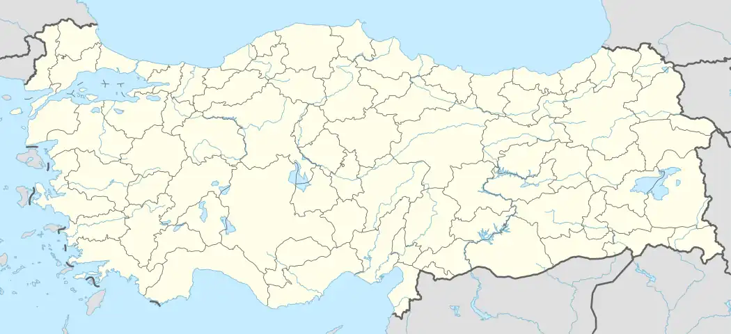 Demirköy District Location in Turkey  Demirköy District Demirköy District (Marmara) | |
| Coordinates: 41°49′N 27°46′E / 41.817°N 27.767°E | |
| Country | Turkey |
| Province | Kırklareli |
| Seat | Demirköy |
| Government | |
| • Kaymakam | Yaşar Şimşek |
| Area | 893 km2 (345 sq mi) |
| Population (2022) | 8,961 |
| • Density | 10/km2 (26/sq mi) |
| Time zone | TRT (UTC+3) |
| Website | www |
Demirköy District is a district of the Kırklareli Province of Turkey. Its seat is the town of Demirköy at the Istranca/Yildiz Mountains at the foot of the Mahya Dağı.[1] Its area is 893 km2,[2] and its population is 8,961 (2022).[3] The population of different Background merged, and are now called simple Hill people (Dağlılar). Some Pictures of the Villages[4]
Demirköy Mountains
- Mahya Dağı (1031 m) is the Highest mountain, followed by:[5]
- Karamanbayır Tepesi (995 m)
- Boyunduruk Tepesi (973 m)
- Fatmakaya Tepesi (901 m)
- Kaynak Tepesi (898 m)
- Paraşüt Tepesi (883 m)
- Meşe Tepesi (872 m)
- Haydut Tepesi (860 m)
- Sivritepe (851 m)
- Kaletepe (846 m)
- Bıçkı Tepesi (726 m)
- Çavuştepe (726 m)
- Dalyantepe (725 m)
- Karakoltepe (719 m)
- Bocalar Tepe (680 m)
- Ceviz Tepe (675 m)
- Yangınkulesi Tepe (629 m)
- Yeltepe (618 m)
- Topkoru Tepe (592 m)
- Soğuksu Tepesi (567 m)
- Büyükbezirgan Tepe (412 m)
- Kocataş Tepesi (281 m)
- Koca Tepe (207 m)
References
- ↑ İlçe Belediyesi, Turkey Civil Administration Departments Inventory. Retrieved 1 March 2023.
- ↑ "İl ve İlçe Yüz ölçümleri". General Directorate of Mapping. Retrieved 1 March 2023.
- ↑ "Address-based population registration system (ADNKS) results dated 31 December 2022, Favorite Reports" (XLS). TÜİK. Retrieved 13 March 2023.
- ↑ https://www.koylerim.com/kirklareli-demkirkoy-364gk.htm
- ↑ https://peakvisor.com/adm/demirkoey.html
Demirköy District in Kırklareli Province of Turkey | |||||||||||||||||||||||||||
|---|---|---|---|---|---|---|---|---|---|---|---|---|---|---|---|---|---|---|---|---|---|---|---|---|---|---|---|
| Districts | 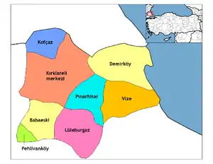 Districts of Kırklareli | ||||||||||||||||||||||||||
| |||||||||||||||||||||||||||
Metropolitan municipalities are bolded. | |||||||||||||||||||||||||||
| Municipalities | |
|---|---|
| Villages |
|
This article is issued from Wikipedia. The text is licensed under Creative Commons - Attribution - Sharealike. Additional terms may apply for the media files.