Democrat Township | |
|---|---|
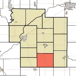 Location of Democrat Township in Carroll County | |
| Coordinates: 40°28′03″N 86°31′32″W / 40.46750°N 86.52556°W | |
| Country | United States |
| State | Indiana |
| County | Carroll |
| Government | |
| • Type | Indiana township |
| Area | |
| • Total | 29.72 sq mi (77.0 km2) |
| • Land | 29.72 sq mi (77.0 km2) |
| • Water | 0 sq mi (0 km2) |
| Elevation | 741 ft (226 m) |
| Population (2010) | |
| • Total | 885 |
| • Density | 29.8/sq mi (11.5/km2) |
| FIPS code | 18-17686[2] |
| GNIS feature ID | 453263 |
Democrat Township is one of fourteen townships in Carroll County, Indiana. As of the 2010 census, its population was 885 and it contained 354 housing units.[3]
History
Democrat Township was organized in 1835.[4]
Adams Mill and Adams Mill Covered Bridge are listed on the National Register of Historic Places.[5]
Geography
According to the 2010 census, the township has a total area of 29.72 square miles (77.0 km2), all land.[3]
Unincorporated towns
Adjacent townships
- Monroe (north)
- Burlington (east)
- Warren Township, Clinton County (southeast)
- Owen Township, Clinton County (south)
- Ross Township, Clinton County (southwest)
- Clay (west)
- Madison (west)
Major highways
Education
Democrat Township residents may obtain a library card at the Flora-Monroe Township Public Library in Flora.[6]
References
- "Democrat Township, Carroll County, Indiana". Geographic Names Information System. United States Geological Survey, United States Department of the Interior. Retrieved September 24, 2009.
- United States Census Bureau cartographic boundary files
- ↑ "US Board on Geographic Names". United States Geological Survey. October 25, 2007. Retrieved January 31, 2008.
- ↑ "U.S. Census website". United States Census Bureau. Retrieved January 31, 2008.
- 1 2 "Population, Housing Units, Area, and Density: 2010 - County -- County Subdivision and Place -- 2010 Census Summary File 1". United States Census. Archived from the original on February 12, 2020. Retrieved May 10, 2013.
- ↑ Odell, John Curtis (1916). History of Carroll County, Indiana: Its People, Industries and Institutions. B.F. Bowen. p. 83.
- ↑ "National Register Information System". National Register of Historic Places. National Park Service. July 9, 2010.
- ↑ "Libraries". Carroll County, IN. Archived from the original on March 4, 2018. Retrieved March 4, 2018.
External links
Municipalities and communities of Carroll County, Indiana, United States | ||
|---|---|---|
| City | Map of Indiana highlighting Carroll County | |
| Towns | ||
| Townships | ||
| CDPs | ||
| Other communities | ||
This article is issued from Wikipedia. The text is licensed under Creative Commons - Attribution - Sharealike. Additional terms may apply for the media files.