Doucette | |
|---|---|
 Doucette Location within the state of Texas  Doucette Doucette (the United States) | |
| Coordinates: 30°49′6″N 94°25′44″W / 30.81833°N 94.42889°W | |
| Country | United States |
| State | Texas |
| County | Tyler |
| Elevation | 331 ft (101 m) |
| Time zone | UTC-6 (Central (CST)) |
| • Summer (DST) | UTC-5 (CDT) |
| ZIP codes | 75942 |
| GNIS feature ID | 1356206[1] |
Doucette is an unincorporated community in central Tyler County, Texas, United States. It lies along U.S. Route 69, north of the town of Woodville, the county seat of Tyler County.[2] Although Doucette is unincorporated, it has a post office, with the ZIP code of 75942.[3]
References
- 1 2 U.S. Geological Survey Geographic Names Information System: Doucette, Texas
- ↑ Rand McNally. The Road Atlas '08. Chicago: Rand McNally, 2008, p. 100.
- ↑ Zip Code Lookup Archived June 15, 2011, at the Wayback Machine
Municipalities and communities of Tyler County, Texas, United States | ||
|---|---|---|
| Cities | 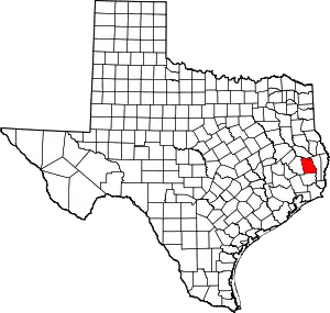 Tyler County map | |
| Towns | ||
| CDPs | ||
| Other communities | ||
| Footnotes | ‡This populated place also has portions in an adjacent county or counties | |
This article is issued from Wikipedia. The text is licensed under Creative Commons - Attribution - Sharealike. Additional terms may apply for the media files.