Dyer, Nevada | |
|---|---|
 | |
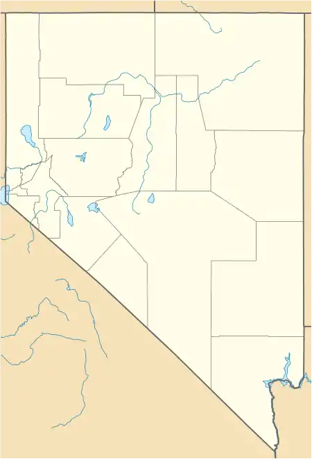 Dyer Location within the state of Nevada | |
| Coordinates: 37°40′03″N 118°03′59″W / 37.66750°N 118.06639°W[1] | |
| Country | United States |
| State | Nevada |
| County | Esmeralda |
| Area | |
| • Total | 35.23 sq mi (91.25 km2) |
| • Land | 35.14 sq mi (91.01 km2) |
| • Water | 0.09 sq mi (0.23 km2) |
| Elevation | 4,880 ft (1,490 m) |
| Population (2020) | |
| • Total | 232 |
| • Density | 6.60/sq mi (2.55/km2) |
| Time zone | UTC-8 (Pacific (PST)) |
| • Summer (DST) | UTC-7 (PDT) |
| ZIP code | 89010 |
| FIPS code | 32-20700 |
| GNIS feature ID | 859604 |
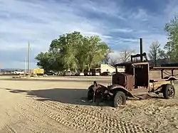
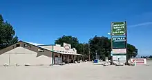
Dyer is an unincorporated town, located in Fish Lake Valley, Esmeralda County, Nevada, United States. It had a population of 324 as of the 2018 American Community Survey.[3] The town serves the surrounding area's sparse rural population of mainly ranchers and indigenous Paiute people. The town has a gas station/store, cafe, post office and airport.
Dyer is located on State Route 264, near Nevada's border with California. It is 25 miles (40 km) south of U.S. Route 6 and 15 miles (24 km) north of Oasis, California. The town is part of the Dyer Census Designated Place.
Demographics
| Census | Pop. | Note | %± |
|---|---|---|---|
| 2020 | 232 | — | |
| U.S. Decennial Census[4] | |||
History
The post office at Dyer has been in operation since 1889.[5] The community took its name from nearby Dyer's Ranch.[6]
Education
Residents are zoned to the Esmeralda County School District for grades K-8.[7]
High school students in the entire county go to Tonopah High School of Nye County School District.[8]
Climate
The Köppen Climate System classifies the weather in this area as semi-arid, abbreviated BSk. This climate type occurs primarily on the periphery of true deserts in low-latitude semiarid steppe regions.[9]
| Climate data for Dyer, Nevada | |||||||||||||
|---|---|---|---|---|---|---|---|---|---|---|---|---|---|
| Month | Jan | Feb | Mar | Apr | May | Jun | Jul | Aug | Sep | Oct | Nov | Dec | Year |
| Mean daily maximum °C (°F) | 8 (46) |
11 (52) |
15 (59) |
19 (67) |
24 (76) |
30 (86) |
34 (93) |
33 (91) |
28 (83) |
22 (71) |
14 (57) |
8 (47) |
21 (69) |
| Mean daily minimum °C (°F) | −9 (16) |
−6 (22) |
−3 (26) |
−1 (31) |
4 (39) |
8 (47) |
12 (53) |
11 (51) |
6 (43) |
0 (32) |
−6 (22) |
−9 (15) |
1 (33) |
| Average precipitation mm (inches) | 13 (0.5) |
13 (0.5) |
10 (0.4) |
13 (0.5) |
13 (0.5) |
7.6 (0.3) |
10 (0.4) |
10 (0.4) |
10 (0.4) |
10 (0.4) |
10 (0.4) |
7.6 (0.3) |
130 (5) |
| Source: Weatherbase [10] | |||||||||||||
References
- 1 2 U.S. Geological Survey Geographic Names Information System: Dyer
- ↑ "ArcGIS REST Services Directory". United States Census Bureau. Retrieved September 19, 2022.
- ↑ "Census - Geography Profile". Retrieved April 12, 2020.
- ↑ "Census of Population and Housing". Census.gov. Retrieved June 4, 2016.
- ↑ "Post Offices". Jim Forte Postal History. Retrieved April 13, 2018.
- ↑ Federal Writers' Project (1941). Origin of Place Names: Nevada (PDF). W.P.A. p. 31.
- ↑ "2020 CENSUS - SCHOOL DISTRICT REFERENCE MAP: Esmeralda County, NV" (PDF). U.S. Census Bureau. Retrieved July 17, 2022. - Text list
- ↑ "Education". Esmeralda County, Nevada. Retrieved July 17, 2022.
- ↑ Climate Summary for Dyer, Nevada
- ↑ "Weatherbase.com". Weatherbase. 2013. Retrieved on September 8, 2013.
Municipalities and communities of Esmeralda County, Nevada, United States | ||
|---|---|---|
| CDPs | 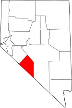 Esmeralda County map | |
| Ghost towns | ||