Egervár | |
|---|---|
Village | |
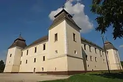 The castle of Egervár | |
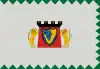 Flag 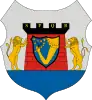 Coat of arms | |
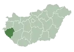
 Egervár Location of Egervár | |
| Coordinates: 46°56′08″N 16°51′13″E / 46.93552°N 16.85365°E | |
| Country | Hungary |
| Region | Western Transdanubia |
| County | Zala |
| District | Zalaegerszeg |
| Area | |
| • Total | 10.29 km2 (3.97 sq mi) |
| Population (1 January 2023)[1] | |
| • Total | 1,067 |
| • Density | 100/km2 (270/sq mi) |
| Time zone | UTC+1 (CET) |
| • Summer (DST) | UTC+2 (CEST) |
| Postal code | 8913 |
| Area code | (+36) 92 |
| Website | egervar |
Egervár is a village[2] on the Sárvíz (Zala) stream in Zala County, Hungary.
Sights
- Castle of Egervár
References
- ↑ Error: Unable to display the reference properly. See the documentation for details.
- ↑ "Summary". Sulinet, educational site of the Hungarian government. Archived from the original on 2008-02-25. Retrieved 2008-05-22.
External links
Wikimedia Commons has media related to Egervár.
.svg.png.webp)
This article is issued from Wikipedia. The text is licensed under Creative Commons - Attribution - Sharealike. Additional terms may apply for the media files.