Estarrona | |
|---|---|
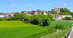 View of Estarrona | |
 Estarrona 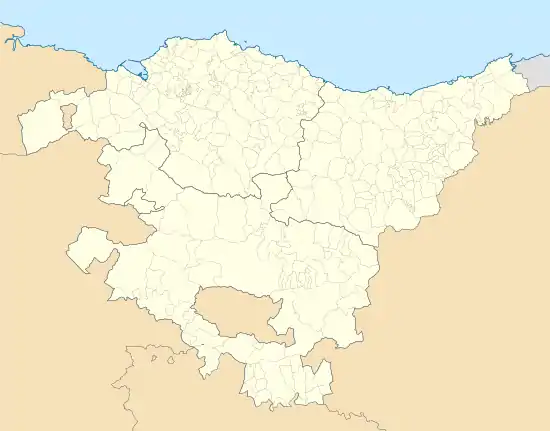 Estarrona  Estarrona | |
| Coordinates: 42°52′N 2°45′W / 42.87°N 2.75°W | |
| Country | Spain |
| Autonomous community | Basque Country |
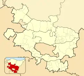
| Province | Álava |
| Comarca | Vitoria-Gasteiz |
| Municipality | Vitoria-Gasteiz |
| Area | |
| • Total | 3.28 km2 (1.27 sq mi) |
| Elevation | 539 m (1,768 ft) |
| Population (2021)[1] | |
| • Total | 57 |
| • Density | 17/km2 (45/sq mi) |
| Postal code | 01191 |
Estarrona (Spanish pronunciation: [estaˈrona], Basque: Eztarroa [es̻taroa])[2] is a hamlet and concejo located in the municipality of Vitoria-Gasteiz, in Álava province, Basque Country, Spain.
References
- ↑ "Nomenclátor: Núcleos". Entidades Locales de Álava (in Spanish). Diputación Foral de Álava. p. 1 January 2021. Retrieved 20 May 2022.
- ↑ Salaberri Zaratiegi, Patxi (2015). Araba/Álava: Los nombres de nuestros pueblos (PDF) (in Spanish). Euskaltzaindia. p. 184. ISBN 978-84-944512-0-1. Retrieved 7 October 2022.
External links
 Media related to Estarroa at Wikimedia Commons
This article is issued from Wikipedia. The text is licensed under Creative Commons - Attribution - Sharealike. Additional terms may apply for the media files.