Falanthos
Φάλανθος | |
|---|---|
 Falanthos Location within the regional unit 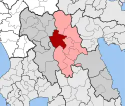 | |
| Coordinates: 37°34′N 22°15′E / 37.567°N 22.250°E | |
| Country | Greece |
| Administrative region | Peloponnese |
| Regional unit | Arcadia |
| Municipality | Tripoli |
| • Municipal unit | 208.5 km2 (80.5 sq mi) |
| Population (2011)[1] | |
| • Municipal unit | 402 |
| • Municipal unit density | 1.9/km2 (5.0/sq mi) |
| Time zone | UTC+2 (EET) |
| • Summer (DST) | UTC+3 (EEST) |
| Vehicle registration | TP |
Falanthos (Greek: Φάλανθος) is a former municipality in Arcadia, Peloponnese, Greece. Since the 2011 local government reform it is part of the municipality Tripoli, of which it is a municipal unit.[2] The municipal unit has an area of 208.545 km2.[3] In 2011 its population was 402.
Subdivisions
The municipal unit Falanthos is subdivided into the following communities (constituent villages in brackets):
- Alonistaina
- Chrysovitsi (Chrysovitsi, Manteika)
- Mainalo
- Piana
- Roeino
- Silimna
- Tselepakos (Tselepakos, Davia, Kato Davia)
Population
| Year | Population |
|---|---|
| 1991 | 1,296 |
| 2001 | 1,310 |
| 2011 | 402 |
References
- ↑ "Απογραφή Πληθυσμού - Κατοικιών 2011. ΜΟΝΙΜΟΣ Πληθυσμός" (in Greek). Hellenic Statistical Authority.
- ↑ "ΦΕΚ B 1292/2010, Kallikratis reform municipalities" (in Greek). Government Gazette.
- ↑ "Population & housing census 2001 (incl. area and average elevation)" (PDF) (in Greek). National Statistical Service of Greece. Archived from the original (PDF) on 2015-09-21.
External links
Places adjacent to Falanthos | ||||||||||||||||
|---|---|---|---|---|---|---|---|---|---|---|---|---|---|---|---|---|
| ||||||||||||||||
This article is issued from Wikipedia. The text is licensed under Creative Commons - Attribution - Sharealike. Additional terms may apply for the media files.