| Fitling | |
|---|---|
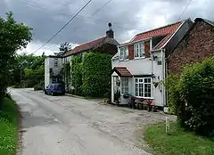 Fitling Lane | |
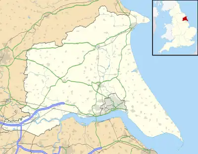 Fitling Location within the East Riding of Yorkshire | |
| OS grid reference | TA252339 |
| • London | 155 mi (249 km) S |
| Civil parish | |
| Unitary authority | |
| Ceremonial county | |
| Region | |
| Country | England |
| Sovereign state | United Kingdom |
| Post town | HULL |
| Postcode district | HU12 |
| Dialling code | 01964 |
| Police | Humberside |
| Fire | Humberside |
| Ambulance | Yorkshire |
| UK Parliament | |
Fitling is a hamlet in the civil parish of East Garton, in the East Riding of Yorkshire, England, in an area known as Holderness. It is situated approximately 7 miles (11 km) north-west of Withernsea town centre. It lies 1 mile (1.6 km) west of the B1242 road.
Fitling was formerly a township in the parish of Humbleton,[1] in 1866 Fitling became a civil parish, on 1 April 1935 the parish was abolished to form East Garton.[2] In 1931 the parish had a population of 85.[3]
In 1823 parish inhabitants numbered 119. Occupations included ten farmers and a shoemaker.[4]
References
- ↑ "History of Fitling, in East Riding of Yorkshire and East Riding". A Vision of Britain through Time. Retrieved 24 November 2023.
- ↑ "Relationships and changes Fitling CP/Tn through time". A Vision of Britain through Time. Retrieved 24 November 2023.
- ↑ "Population statistics Fitling CP/Tn through time". A Vision of Britain through Time. Retrieved 24 November 2023.
- ↑ Baines, Edward (1823). History, Directory & Gazetteer of the County of York. p. 204. ISBN 1230139141.
- Gazetteer — A–Z of Towns Villages and Hamlets. East Riding of Yorkshire Council. 2006. p. 5.
External links
![]() Media related to Fitling at Wikimedia Commons
Media related to Fitling at Wikimedia Commons
- Fitling in the Domesday Book
| Unitary authorities | |
|---|---|
| Major settlements (cities in italics) | |
| Rivers | |
| Canals | |
| Topics | |
This article is issued from Wikipedia. The text is licensed under Creative Commons - Attribution - Sharealike. Additional terms may apply for the media files.