| Foel Goch | |
|---|---|
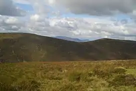 Foel Goch (Right) and Trum y Gwragedd(Left) from Pen y Boncyn Trefeilw | |
| Highest point | |
| Elevation | 613 m (2,011 ft) |
| Prominence | 46 m (151 ft) |
| Parent peak | Esgeiriau Gwynion |
| Listing | Hewitt, Nuttall |
| Coordinates | 52°50′56″N 3°34′14″W / 52.848878°N 3.570602°W |
| Geography | |
| Location | Conwy, Wales |
| Parent range | Snowdonia |
| OS grid | SH943290 |
| Topo map | OS Landranger 115 |
Foel Goch is a subsidiary summit of Esgeiriau Gwynion, and is included in a group of hills known as the Hirnantau. These hills rise from the south east shores of Bala Lake.[1]
The summit is boggy and marked by a few stones. The views are good, with the retrospect of Foel y Geifr and Trum y Gwragedd to the south and northern Snowdonia to the north west.[2]
References
- ↑ Crocker, Chris; Graham Jackson. "Mountaineering & Rock Climbing in the UK: Foel Goch". Database of British Hills. Mountain Days.net. Archived from the original on 19 July 2011. Retrieved 8 April 2008.
- ↑ Nuttall, John & Anne (1999). The Mountains of England & Wales - Volume 1: Wales (2nd edition ed.). Milnthorpe, Cumbria: Cicerone. ISBN 1-85284-304-7.
This article is issued from Wikipedia. The text is licensed under Creative Commons - Attribution - Sharealike. Additional terms may apply for the media files.