| Foldfjord | |
|---|---|
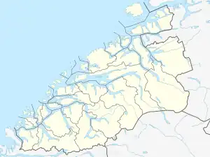 Foldfjord Location of the fjord 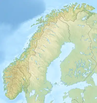 Foldfjord Foldfjord (Norway) | |
| Location | Møre og Romsdal county, Norway |
| Coordinates | 63°15′29″N 8°23′16″E / 63.25806°N 8.38778°E |
| Type | Fjord |
| Basin countries | Norway |
| Max. length | 7 kilometres (4.3 mi) |
| Max. width | 1.2 kilometres (0.75 mi) |
| Max. depth | 74 metres (243 ft) |
| Surface elevation | 0 m (0 ft)[1] |
Foldfjord (Norwegian: Foldfjorden or Follfjorden)[1] is a fjord on the island of Ertvågsøy in the municipality of Aure in Møre og Romsdal county, Norway.[2][3] The fjord's natural surroundings support a large wildlife population, including many red deer. County Road 682 runs along the east shore of the fjord. At the north end, County Road 680 crosses the fjord at a narrow point near Espset.[3] The fjord flows north where it joins Gjerdavika, an arm off Edøyfjorden.
References
- 1 2 "Foldfjorden, Aure (Møre og Romsdal)" (in Norwegian). yr.no. Retrieved March 12, 2017.
- ↑ Store norske leksikon: Ertvågsøya
- 1 2 Norgeskart: Foldfjord.
External links
This article is issued from Wikipedia. The text is licensed under Creative Commons - Attribution - Sharealike. Additional terms may apply for the media files.