Friedberg | |
|---|---|
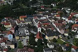 Aerial view | |
 Coat of arms | |
 Friedberg Location within Austria | |
| Coordinates: 47°26′29″N 16°03′29″E / 47.44139°N 16.05806°E | |
| Country | Austria |
| State | Styria |
| District | Hartberg-Fürstenfeld |
| Government | |
| • Mayor | Karl Mathä (ÖVP) |
| Area | |
| • Total | 25.88 km2 (9.99 sq mi) |
| Elevation | 600 m (2,000 ft) |
| Population (2018-01-01)[2] | |
| • Total | 2,601 |
| • Density | 100/km2 (260/sq mi) |
| Time zone | UTC+1 (CET) |
| • Summer (DST) | UTC+2 (CEST) |
| Postal code | 8240 |
| Area code | 03339 |
| Vehicle registration | HB |
| Website | www.friedberg.at |
Friedberg (German pronunciation: [ˈfʁiːtˌbɛʁk] ⓘ) is a town in district Hartberg-Fürstenfeld located in Styria, Austria with 2,562 inhabitants.
Economy and Infrastructure
The train station of Friedberg offers destinations to Wiener Neustadt , Vienna , Hartberg and Fehring. In Friedberg 3 trainlines cross: The Thermenbahn , the Wechselbahn and the Pinkatalbahn.
References
- ↑ "Dauersiedlungsraum der Gemeinden Politischen Bezirke und Bundesländer - Gebietsstand 1.1.2018". Statistics Austria. Retrieved 10 March 2019.
- ↑ "Einwohnerzahl 1.1.2018 nach Gemeinden mit Status, Gebietsstand 1.1.2018". Statistics Austria. Retrieved 9 March 2019.
This article is issued from Wikipedia. The text is licensed under Creative Commons - Attribution - Sharealike. Additional terms may apply for the media files.