Galičica (Macedonian: ⓘ, Albanian: Mali i Thatë) is a mountain situated across the border between North Macedonia and Albania. There is a national park on North Macedonia's side of the mountain, situated between the two biggest lakes in the republic: Lake Ohrid and Lake Prespa. It stretches over an area of 227 square kilometres (88 sq mi).
Galičica is among the richest in endemic species among mountains in North Macedonia.[1] The floral life in the Galičica National Park represents over 1600 species, of which many relicts and endems have the final frontier of its range exactly on the mountain Galičica. At the moment, it is intensively worked on the flora of the National Park and there are indications that the number of endems will be even bigger.
Views of the lakes and neighbouring mountains can be seen from the Galičica peaks. The second-highest peak is Magaro (2,255 m).
The National Park was confirmed by the government to be a national park in 1958.
Gallery
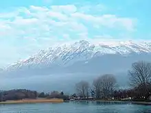
.jpg.webp) View of Ohrid Lake and Prespa Lake from top of Galičica
View of Ohrid Lake and Prespa Lake from top of Galičica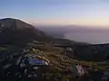 View from Galičica on the south part of Ohrid lake
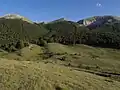 Road pass through Galičica
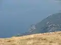 View from Galičica on the north part of Ohrid lake
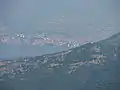 View from Galičica on Ohrid town
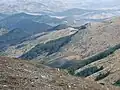 The interior of mountain Galičica
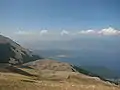 View from Galičica on the south part of Ohrid lake
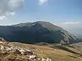 Highest peak, Magaro (2255 m)
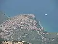 View from Galičica on the village of Trpejca
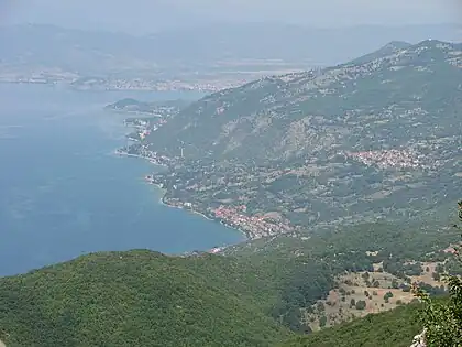 View from Galičica on the east coast of Ohrid lake
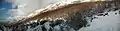 View from Korita
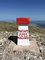 Magaro Peak, 2255 m
See also
External links
References
- ↑ Climate Change Impacts on High-Altitude Ecosystems. Springer International Publishing. 2015. p. 193.
North Macedonia articles | ||||||||||||
|---|---|---|---|---|---|---|---|---|---|---|---|---|
| History |
|  | ||||||||||
| Geography | ||||||||||||
| Politics | ||||||||||||
| Economy | ||||||||||||
| Society |
| |||||||||||