Gbolouville | |
|---|---|
Town and sub-prefecture | |
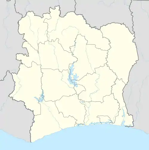 Gbolouville Location in Ivory Coast | |
| Coordinates: 5°47′N 4°40′W / 5.783°N 4.667°W | |
| Country | |
| District | Lagunes |
| Region | Agnéby-Tiassa |
| Department | Tiassalé |
| Area | |
| • Total | 480 km2 (190 sq mi) |
| Population (2021 census)[1] | |
| • Total | 42,476 |
| • Density | 88/km2 (230/sq mi) |
| • Town | 12,591[2] |
| (2014 census) | |
| Time zone | UTC+0 (GMT) |
Gbolouville is a town in southern Ivory Coast. It is a sub-prefecture of Tiassalé Department in Agnéby-Tiassa Region, Lagunes District.
Gbolouville was a commune until March 2012, when it became one of 1126 communes nationwide that were abolished.[3]
In 2021, the population of the sub-prefecture of Gbolouville was 42,476.[1]
Villages
The 9 villages of the sub-prefecture of Gbolouville and their population in 2014 are:[2]
- Akalékro (3 590)
- Akoungou (2 229)
- Amani Kouamékro (638)
- Assinzé (936)
- Botindé (3 676)
- Broubrou (4 221)
- Ehuakré (463)
- Elosso (510)
- Gbolouville (12 591)
Notes
- 1 2 Citypopulation.de Population of the regions and sub-prefectures of Ivory Coast
- 1 2 Citypopulation.de Population of the localities in the sub-prefecture of Gbolouville
- ↑ "Le gouvernement ivoirien supprime 1126 communes, et maintient 197 pour renforcer sa politique de décentralisation en cours", news.abidjan.net, 7 March 2012.
Regional seat: Agboville | ||
| Agboville Department | 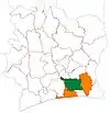 | |
| Sikensi Department | ||
| Taabo Department | ||
| Tiassalé Department | ||
* also a commune | ||
This article is issued from Wikipedia. The text is licensed under Creative Commons - Attribution - Sharealike. Additional terms may apply for the media files.