Gefrees | |
|---|---|
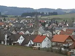 Gefrees seen from the southeast | |
 Coat of arms | |
Location of Gefrees within Bayreuth district 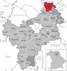 | |
 Gefrees 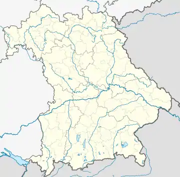 Gefrees | |
| Coordinates: 50°5′42.50″N 11°44′23.41″E / 50.0951389°N 11.7398361°E | |
| Country | Germany |
| State | Bavaria |
| Admin. region | Oberfranken |
| District | Bayreuth |
| Subdivisions | 44 Ortsteile |
| Government | |
| • Mayor (2020–26) | Oliver Dietel[1] |
| Area | |
| • Total | 50.08 km2 (19.34 sq mi) |
| Elevation | 500 m (1,600 ft) |
| Population (2022-12-31)[2] | |
| • Total | 4,264 |
| • Density | 85/km2 (220/sq mi) |
| Time zone | UTC+01:00 (CET) |
| • Summer (DST) | UTC+02:00 (CEST) |
| Postal codes | 95482 |
| Dialling codes | 09254 |
| Vehicle registration | BT |
| Website | www.gefrees.de |
Gefrees (German pronunciation: [ɡəˈfʁeːs] ⓘ) is a town in the district of Bayreuth, in Bavaria, Germany. It is situated in the Fichtel Mountains, 21 km northeast of Bayreuth. It was the site of a battle during the Napoleonic Wars.
References
- ↑ Liste der ersten Bürgermeister/Oberbürgermeister in kreisangehörigen Gemeinden, Bayerisches Landesamt für Statistik, 15 July 2021.
- ↑ Genesis Online-Datenbank des Bayerischen Landesamtes für Statistik Tabelle 12411-003r Fortschreibung des Bevölkerungsstandes: Gemeinden, Stichtag (Einwohnerzahlen auf Grundlage des Zensus 2011)
Towns and municipalities in Bayreuth (district) | ||
|---|---|---|
| Coat of Arms of Bayreuth district | |
This article is issued from Wikipedia. The text is licensed under Creative Commons - Attribution - Sharealike. Additional terms may apply for the media files.