Goodland, Missouri | |
|---|---|
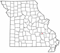 Location of Goodland within Missouri | |
| Coordinates: 37°38′10″N 91°00′11″W / 37.636°N 91.003°W | |
| Country | United States |
| State | Missouri |
| County | Iron |
| Elevation | 951 ft (290 m) |
| Time zone | UTC-6 (Central (CST)) |
| • Summer (DST) | UTC-5 (CDT) |
| Area code | 573 |
| GNIS feature ID | 750074[1] |
Goodland is an unincorporated community in western Iron County, Missouri, United States.[1] It is located on a county road, approximately two miles from Route 49 in the Mark Twain National Forest.
History
A post office called Goodland was established in 1882, and remained in operation until 1966.[2] The community was named for the quality of their land.[3]
References
- 1 2 U.S. Geological Survey Geographic Names Information System: Goodland, Iron County, Missouri
- ↑ "Post Offices". Jim Forte Postal History. Retrieved October 12, 2016.
- ↑ "Iron County Place Names, 1928–1945 (archived)". The State Historical Society of Missouri. Archived from the original on June 24, 2016. Retrieved October 12, 2016.
{{cite web}}: CS1 maint: bot: original URL status unknown (link)
Municipalities and communities of Iron County, Missouri, United States | ||
|---|---|---|
| Cities | 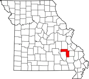 Map of Missouri highlighting Iron County | |
| Village | ||
| Townships | ||
| Unincorporated communities | ||
| Ghost towns | ||
| Footnotes | ‡This populated place also has portions in an adjacent county or counties | |
This article is issued from Wikipedia. The text is licensed under Creative Commons - Attribution - Sharealike. Additional terms may apply for the media files.