| Gravelly Branch Tributary to Nanticoke River | |
|---|---|
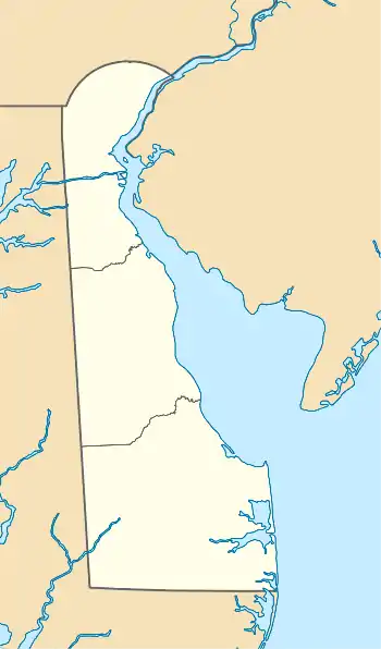 Location of Gravelly Branch mouth  Gravelly Branch (Nanticoke River tributary) (the United States) | |
| Location | |
| Country | United States |
| State | Delaware |
| County | Sussex |
| Physical characteristics | |
| Source | Ellendale Swamp on Sowbridge Branch divide |
| • location | about 1 mile south-southeast of Ellendale, Delaware |
| • coordinates | 38°48′20″N 075°24′35″W / 38.80556°N 75.40972°W[1] |
| • elevation | 45 ft (14 m)[2] |
| Mouth | Nanticoke River |
• location | about 2 miles northeast of Middleford, Delaware |
• coordinates | 38°41′11″N 075°33′21″W / 38.68639°N 75.55583°W[1] |
• elevation | 3 ft (0.91 m)[3] |
| Length | 13.12 mi (21.11 km)[4] |
| Basin size | 39.09 square miles (101.2 km2)[5] |
| Discharge | |
| • location | Nanticoke River |
| • average | 47.77 cu ft/s (1.353 m3/s) at mouth with Nanticoke River[5] |
| Basin features | |
| Progression | Nanticoke River → Chesapeake Bay → Atlantic Ocean |
| River system | Nanticoke River |
| Tributaries | |
| • left | Gravelly Ditch |
| • right | Prong Number One Smith-Short and Willin Ditch Tussocky Branch |
| Waterbodies | Collins Pond |
| Bridges | Saw Mill Road (x2), US 113, W Robbins Road, Redden Road, Deer Forest Road, DE 18-404, Coverdale Road |
Gravelly Branch is a 13.12 mi (21.11 km) long 4th order tributary to the Nanticoke River in Sussex County, Delaware.
Variant names
According to the Geographic Names Information System, it has also been known historically as:[1]
- Gravel Creek
- Gravely Branch
Course
Gravelly Branch rises in Ellendale Swamp on the Sowbridge Branch divide about 1 mile south-southeast of Ellendale, Delaware, and then flows southwest to join the Nanticoke River about 2 miles northeast of Middleford.[3]
Watershed
Gravelly Branch drains 39.09 square miles (101.2 km2) of area, receives about 45.2 in/year of precipitation, has a wetness index of 741.95, and is about 19% forested.[5]
See also
References
- 1 2 3 "GNIS Detail - Gravelly Branch". geonames.usgs.gov. US Geological Survey. Retrieved 19 May 2021.
- ↑ "Get Maps". USGS Topoview. US Geological Survey. Retrieved 19 May 2021.
- 1 2 "Get Maps". USGS Topoview. US Geological Survey. Retrieved 19 May 2021.
- ↑ "ArcGIS Web Application". epa.maps.arcgis.com. US EPA. Retrieved 19 May 2021.
- 1 2 3 "Gravelly Branch Watershed Report". US EPA Geoviewer. US EPA. Retrieved 19 May 2021.
This article is issued from Wikipedia. The text is licensed under Creative Commons - Attribution - Sharealike. Additional terms may apply for the media files.