Griffin | |
|---|---|
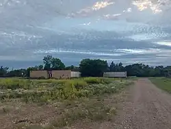 Abandoned school in Griffin | |
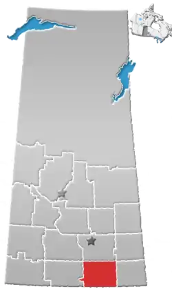
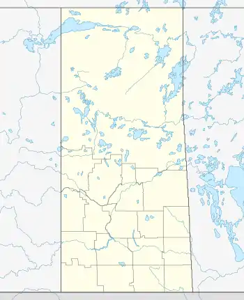 Griffin Location in Saskatchewan  Griffin Griffin (Canada) | |
| Coordinates: 49°40′00″N 103°26′02″W / 49.66667°N 103.43389°W | |
| Country | Canada |
| Province | Saskatchewan |
| Region | Southeast Saskatchewan |
| Census division | 2 |
| Rural Municipality | Griffin |
| Government | |
| • Federal Electoral District M.P. | Robert Kitchen (CPC - Souris—Moose Mountain) |
| • Provincial Constituency M.L.A. | Dan D'Autremont (SK - Cannington) |
| Area | |
| • Land | 0.62 km2 (0.24 sq mi) |
| Population (2016) | |
| • Total | 111 |
| • Density | 177.9/km2 (461/sq mi) |
| Time zone | CST |
| Postal code | S0C 1G0 |
| Area code | 306 |
| Highways | Highway 13 Highway 606 |
| Railways | Canadian Pacific |
| [1][2][3][4] | |
Griffin is a special service area within the Rural Municipality of Griffin No. 66 in the Canadian province of Saskatchewan.[5] Listed as a designated place by Statistics Canada, the community had a population of 111 (a 73.4% increase from 2011) in the Canada 2016 Census.[6] The community is also the seat of the Rural Municipality of Griffin No. 66.[7]
Demographics
In the 2021 Census of Population conducted by Statistics Canada, Griffin had a population of 128 living in 45 of its 55 total private dwellings, a change of 15.3% from its 2016 population of 111. With a land area of 0.61 km2 (0.24 sq mi), it had a population density of 209.8/km2 (543.5/sq mi) in 2021.[8]
Canada census – Griffin, Saskatchewan community profile
| 2016 | 2011 | |
|---|---|---|
| Population | 111 (+ 73.4% from 2011) | 64 (+ 30.6% from 2006) |
| Land area | 0.62 km2 (0.24 sq mi) | 0.62 km2 (0.24 sq mi) |
| Population density | 177.9/km2 (461/sq mi) | 102.5/km2 (265/sq mi) |
| Median age | 28.5 (M: 29.5, F: 27.8) | 32.5 (M: 30.8, F: 36.8) |
| Private dwellings | 54 (total) | 36 (total) |
| Median household income | $Not Available | $Not Available |
See also
References
- ↑ National Archives, Archivia Net, Post Offices and Postmasters, archived from the original on October 6, 2006
- ↑ Government of Saskatchewan, MRD Home, Municipal Directory System, archived from the original on November 21, 2008
- ↑ Canadian Textiles Institute. (2005), CTI Determine your provincial constituency, archived from the original on September 11, 2007
- ↑ Commissioner of Canada Elections, Chief Electoral Officer of Canada (2005), Elections Canada On-line, archived from the original on April 21, 2007
- ↑ "Municipal Directory System" (PDF). Government of Saskatchewan. p. 227. Retrieved November 19, 2016.
- ↑ Canada 2016 Census: Designated places in Saskatchewan
- ↑ Rural Municipality of Griffin No. 66
- ↑ "Population and dwelling counts: Canada and designated places". Statistics Canada. February 9, 2022. Retrieved August 31, 2022.
- ↑ "2016 Community Profiles". 2016 Canadian Census. Statistics Canada. August 12, 2021.
- ↑ "2011 Community Profiles". 2011 Canadian Census. Statistics Canada. March 21, 2019.
- ↑ "2006 Community Profiles". 2006 Canadian Census. Statistics Canada. August 20, 2019.
- ↑ "2001 Community Profiles". 2001 Canadian Census. Statistics Canada. July 18, 2021.
This article is issued from Wikipedia. The text is licensed under Creative Commons - Attribution - Sharealike. Additional terms may apply for the media files.