Guará | |
|---|---|
.png.webp) Flag .png.webp) Coat of arms | |
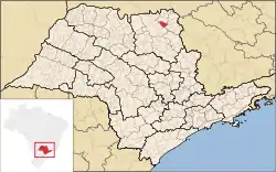 Location in São Paulo state | |
 Guará Location in Brazil | |
| Coordinates: 20°25′42″S 47°49′27″W / 20.42833°S 47.82417°W | |
| Country | Brazil |
| Region | Southeast |
| State | São Paulo |
| Area | |
| • Total | 362 km2 (140 sq mi) |
| Population (2020 [1]) | |
| • Total | 21,308 |
| • Density | 59/km2 (150/sq mi) |
| Time zone | UTC−3 (BRT) |
Guará is a municipality situated in the northern part of the state of São Paulo in Brazil. The population is 21,308 (2020 est.) in an area of 362 km2.[2] The elevation is 573 m.[3]
This place name comes from the Tupi language for two animals common in the region, the maned wolf (Chrysocyon brachyurus) and the scarlet ibis (Eudocimus ruber).[4]
References
- ↑ IBGE 2020
- ↑ Instituto Brasileiro de Geografia e Estatística
- ↑ IBGE — Cidades (in Portuguese)
- ↑ Henrique de Beaurepaire-Rohan (1889), "Guará", Diccionario de Vocabulos Brazileiros, Imprensa nacional, p. 71a
External links
This article is issued from Wikipedia. The text is licensed under Creative Commons - Attribution - Sharealike. Additional terms may apply for the media files.