Guararapes | |
|---|---|
 | |
 Flag  Coat of arms | |
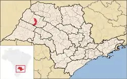 Location in São Paulo state | |
 Guararapes Location in Brazil | |
| Coordinates: 21°15′39″S 50°38′34″W / 21.26083°S 50.64278°W | |
| Country | Brazil |
| Region | Southeast |
| State | São Paulo |
| Area | |
| • Total | 956 km2 (369 sq mi) |
| Population (2020 [1]) | |
| • Total | 33,100 |
| • Density | 35/km2 (90/sq mi) |
| Time zone | UTC−3 (BRT) |
Guararapes is a municipality near Araçatuba in the state of São Paulo in Brazil. The population is 33,100 (2020 est.) in an area of 956 km².[2] The elevation is 415 m. This place name comes from the Tupi language, meaning "drums".
References
This article is issued from Wikipedia. The text is licensed under Creative Commons - Attribution - Sharealike. Additional terms may apply for the media files.