| Höch Turm | |
|---|---|
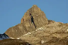 The east face from Braunwald | |
| Highest point | |
| Elevation | 2,666 m (8,747 ft) |
| Prominence | 264 m (866 ft)[1] |
| Parent peak | Ortstock |
| Isolation | 1 km (0.62 mi) |
| Coordinates | 46°55′55.7″N 8°56′8.6″E / 46.932139°N 8.935722°E |
| Geography | |
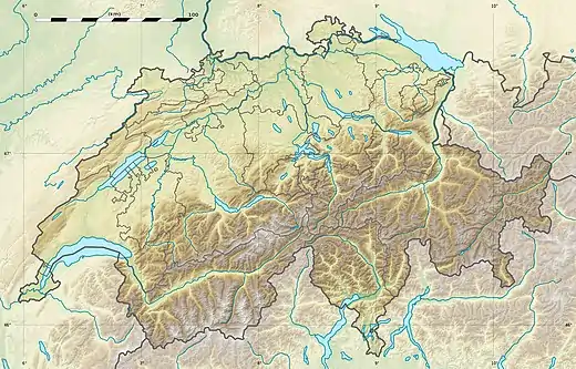 Höch Turm Location in Switzerland | |
| Location | Schwyz, Switzerland |
| Parent range | Schwyzer Alps |
The Höch Turm is a mountain in the Schwyzer Alps, located in an elevation of 2,666 m (8,747 ft). It lies west of the resort village of Braunwald on the karstic range between the valleys of Muota and Linth.[2]
Administratively, the mountain lies in the municipality of Muotathal, in the canton of Schwyz.[2]
References
- ↑ Retrieved from the Swisstopo topographic maps. The key col is the Furggele (2,402 m).
- 1 2 map.geo.admin.ch (Map). Swiss Confederation. Retrieved 2015-06-10.
External links
 Media related to Höch Turm at Wikimedia Commons
- Höch Turm on Hikr
This article is issued from Wikipedia. The text is licensed under Creative Commons - Attribution - Sharealike. Additional terms may apply for the media files.