Canlubang | |
|---|---|
| Barangay ng Halang Lungsod ng Calamba | |
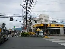 Street view of Barangay Halang | |
location of the barangays | |
| Coordinates: 14°11′43″N 121°10′19″E / 14.19528°N 121.17194°E | |
| Country | Philippines |
| Province | Laguna |
| Region | Calabarzon (Region IV-A) |
| City | Calamba |
| Government | |
| • Chairman | Aries O. Silva |
| • Councilors |
|
| Area | |
| • Land | 1.667 km2 (0.644 sq mi) |
| Population (2020) | |
| • Total | 8,582 |
Halang is an urban barangay in Calamba, Laguna, Philippines. It is situated in the east portion of the city (Calamba). Halang is one of the richest barangays in Calamba.[1]
Neighboring Barangays
| Directions | Barangays |
|---|---|
| West | Real & La Mesa |
| East | (Aplaya) Laguna de Bay |
| South | Bucal |
| North | Lecheria |
Population
| Year | Population | Household |
|---|---|---|
| 2014 | 7,943 | 1,834 |
| 2013 | 7,649 | 1,766 |
| 2012 | 7,365 | 1,701 |
| 2011 | 7,092 | 1,638 |
| 2010 | 6,829 | 1,729 |
| 2007 | 6,442 | 1,385 |
| 2000 | 5,591 | 1,116 |
| 1995 | 5,742 | |
| 1990 | 3,750 | |
| 1980 | 1,446 |
See also
Gallery
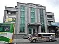 Plan Bank in Halang
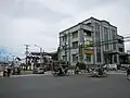 At Barangay Halang at the center point
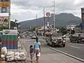 National Highway Crossing at Barangay Halang
References
Places adjacent to Halang, Calamba | ||||||||||||||||
|---|---|---|---|---|---|---|---|---|---|---|---|---|---|---|---|---|
| ||||||||||||||||
| Geography |
| ||||||
|---|---|---|---|---|---|---|---|
| City |
| ||||||
| Officials | |||||||
| History |
| ||||||
| Barangays |
| ||||||
| Sister cities | |||||||
| Notable people | |||||||
This article is issued from Wikipedia. The text is licensed under Creative Commons - Attribution - Sharealike. Additional terms may apply for the media files.