| Hudson Branch Tributary to Hyco River | |
|---|---|
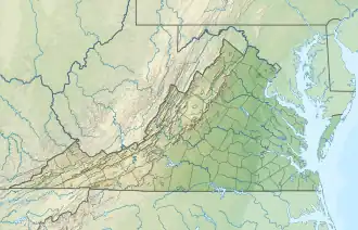 Location of Hudson Branch mouth  Hudson Branch (Hyco River tributary) (the United States) | |
| Location | |
| Country | United States |
| State | Virginia |
| County | Halifax |
| Physical characteristics | |
| Source | Grassy Creek divide |
| • location | pond in Centerville, Virginia |
| • coordinates | 36°38′36″N 078°51′27″W / 36.64333°N 78.85750°W[1] |
| • elevation | 448 ft (137 m)[2] |
| Mouth | Hyco River |
• location | about 2.5 miles southeast of Centerville, Virginia |
• coordinates | 36°37′58″N 078°49′21″W / 36.63278°N 78.82250°W[1] |
• elevation | 320 ft (98 m)[2] |
| Length | 2.19 mi (3.52 km)[3] |
| Basin size | 2.12 square miles (5.5 km2)[4] |
| Discharge | |
| • location | Hyco River |
| • average | 2.77 cu ft/s (0.078 m3/s) at mouth with Hyco River[4] |
| Basin features | |
| Progression | southeast |
| River system | Roanoke River |
| Tributaries | |
| • left | unnamed tributaries |
| • right | unnamed tributaries |
| Bridges | none |
Hudson Branch is a 2.19 mi (3.52 km) long 2nd order tributary to the Hyco River in Halifax County, Virginia.
Course
Hudson Branch rises in a pond in Centerville, Virginia, and then flows southeast to join the Hyco River about 2.5 miles southeast of Centerville.[2]
Watershed
Hudson Branch drains 2.12 square miles (5.5 km2) of area, receives about 45.7 in/year of precipitation, has a wetness index of 384.85, and is about 67% forested.[4]
See also
References
- 1 2 "GNIS Detail - Hudson Branch". geonames.usgs.gov. US Geological Survey. Retrieved 1 November 2020.
- 1 2 3 "Get Maps". USGS Topoview. US Geological Survey. Retrieved 1 November 2020.
- ↑ "ArcGIS Web Application". epa.maps.arcgis.com. US EPA. Retrieved 1 November 2020.
- 1 2 3 "Hudson Branch Watershed Report". US EPA Geoviewer. US EPA. Retrieved 1 November 2020.
This article is issued from Wikipedia. The text is licensed under Creative Commons - Attribution - Sharealike. Additional terms may apply for the media files.