Ideal | |
|---|---|
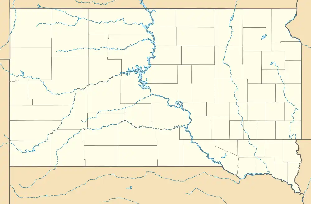 Ideal Location within the state of South Dakota  Ideal Ideal (the United States) | |
| Coordinates: 43°32′24″N 99°55′18″W / 43.54000°N 99.92167°W | |
| Country | United States |
| State | South Dakota |
| County | Tripp |
| Area | |
| • Total | 0.51 sq mi (1.33 km2) |
| • Land | 0.51 sq mi (1.33 km2) |
| • Water | 0.00 sq mi (0.00 km2) |
| Elevation | 1,887 ft (575 m) |
| Population | |
| • Total | 86 |
| • Density | 167.32/sq mi (64.57/km2) |
| Time zone | UTC-6 (Central (CST)) |
| • Summer (DST) | UTC-5 (CDT) |
| ZIP codes | 57541 |
| Area code | 605 |
| FIPS code | 46-31220 |
| GNIS feature ID | 2813065[2] |
Ideal is an unincorporated community in northern Tripp County, South Dakota, United States. It lies north of the city of Winner, the county seat.[4] Its elevation is 1,886 feet (575 m).[2] The population of the CDP was 86 at the 2020 census.[5]
Ideal's town site was considered to be "ideal" for farming, hence the name.[6]
Education
The community is served by Winner School District 59-2.
Demographics
| Census | Pop. | Note | %± |
|---|---|---|---|
| 2020 | 86 | — | |
| U.S. Decennial Census[7] | |||
References
- ↑ "ArcGIS REST Services Directory". United States Census Bureau. Retrieved October 15, 2022.
- 1 2 3 U.S. Geological Survey Geographic Names Information System: Ideal, South Dakota
- ↑ "Census Population API". United States Census Bureau. Retrieved October 15, 2022.
- ↑ Rand McNally. The Road Atlas '05. Chicago: Rand McNally, 2005, p. 93.
- ↑ "U.S. Census Bureau: Ideal CDP, South Dakota". www.census.gov. United States Census Bureau. Retrieved December 23, 2021.
- ↑ Federal Writers' Project (1940). South Dakota place-names, v.1-3. University of South Dakota. p. 43.
- ↑ "Census of Population and Housing". Census.gov. Retrieved June 4, 2016.
Municipalities and communities of Tripp County, South Dakota, United States | ||
|---|---|---|
| Cities | 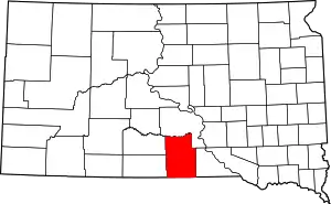 Tripp County map | |
| Town | ||
| CDP | ||
| Other communities | ||
| Indian reservation | ||
| Footnotes | ‡This populated place also has portions in an adjacent county or counties | |
This article is issued from Wikipedia. The text is licensed under Creative Commons - Attribution - Sharealike. Additional terms may apply for the media files.