| Ikva | |
|---|---|
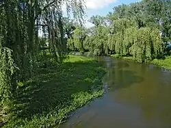 Ikva near Dubno | |
| Native name | Іква (Ukrainian) |
| Location | |
| Country | Ukraine |
| Physical characteristics | |
| Source | |
| • location | Chernytsia,[1] Zolochiv Raion, Ukraine |
| • coordinates | 49°57′56″N 25°13′45″E / 49.96556°N 25.22917°E |
| Mouth | Styr River |
• coordinates | 50°33′51″N 25°23′42″E / 50.5641°N 25.3950°E |
| Length | 155 kilometres (96 mi) |
| Basin size | 2,250 square kilometres (869 sq mi) |
| Basin features | |
| Progression | Styr→ Pripyat→ Dnieper→ Dnieper–Bug estuary→ Black Sea |
The Ikva (Ukrainian: Іква) is a river in Ukraine and a right tributary of the Styr River that flows through Lviv Oblast, Ternopil Oblast and Rivne Oblast in the Volhynian Upland.[1]
It is 155 kilometres (96 mi) long and its basin area is 2,250 square kilometres (869 sq mi).[1] The river has at least one water reservoir near Mlyniv. Among its main tributaries is the Tartatska (right).[1] The city of Dubno is located on the Ikva.[1]
References
This article is issued from Wikipedia. The text is licensed under Creative Commons - Attribution - Sharealike. Additional terms may apply for the media files.