| Jagged Mountain | |
|---|---|
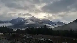 Jagged Mountain as seen from Highway 19 | |
| Highest point | |
| Elevation | 1,708 m (5,604 ft) |
| Prominence | 753 m (2,470 ft) |
| Coordinates | 50°16′01.9″N 126°17′28.0″W / 50.267194°N 126.291111°W |
| Geography | |
| Location | Vancouver Island, British Columbia, Canada |
| District | Rupert Land District |
| Parent range | Vancouver Island Ranges |
| Topo map | NTS 92L8 Adam River |
Jagged Mountain is a mountain on Vancouver Island, British Columbia, Canada, located 23 km (14 mi) east of Woss and 6 km (4 mi) north of Mount Abel.[1]
See also
References
- ↑ "Jagged Mountain". Bivouac.com.
External links
This article is issued from Wikipedia. The text is licensed under Creative Commons - Attribution - Sharealike. Additional terms may apply for the media files.