Jedlany | |
|---|---|
 Main road | |
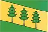 Flag 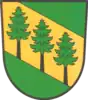 Coat of arms | |
 Jedlany Location in the Czech Republic | |
| Coordinates: 49°29′41″N 14°42′59″E / 49.49472°N 14.71639°E | |
| Country | |
| Region | South Bohemian |
| District | Tábor |
| First mentioned | 1369 |
| Area | |
| • Total | 4.21 km2 (1.63 sq mi) |
| Elevation | 486 m (1,594 ft) |
| Population (2023-01-01)[1] | |
| • Total | 74 |
| • Density | 18/km2 (46/sq mi) |
| Time zone | UTC+1 (CET) |
| • Summer (DST) | UTC+2 (CEST) |
| Postal code | 391 37 |
| Website | www |
Jedlany is a municipality and village in Tábor District in the South Bohemian Region of the Czech Republic. It has about 70 inhabitants.
Jedlany lies approximately 10 kilometres (6 mi) north-east of Tábor, 60 km (37 mi) north of České Budějovice, and 70 km (43 mi) south of Prague.
Gallery
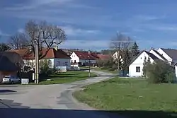
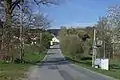 Main road
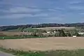 General view
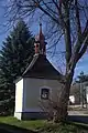 Chapel
References
Wikimedia Commons has media related to Jedlany.
This article is issued from Wikipedia. The text is licensed under Creative Commons - Attribution - Sharealike. Additional terms may apply for the media files.