| Johnson Creek Tributary to Ararat River | |
|---|---|
 Location of Johnson Creek mouth  Johnson Creek (Ararat River tributary) (the United States) | |
| Location | |
| Country | United States |
| State | North Carolina Virginia |
| County | Surry Patrick (VA) Carroll |
| Physical characteristics | |
| Source | Grassy Creek divide |
| • location | Orchard Gap, Virginia |
| • coordinates | 36°39′19″N 080°35′33″W / 36.65528°N 80.59250°W[1] |
| • elevation | 2,620 ft (800 m)[2] |
| Mouth | Ararat River |
• location | about 0.1 miles southwest of Sulphur Springs, North Carolina |
• coordinates | 36°32′10″N 080°34′51″W / 36.53611°N 80.58083°W[1] |
• elevation | 1,050 ft (320 m)[2] |
| Length | 10.71 mi (17.24 km)[3] |
| Basin size | 18.60 square miles (48.2 km2)[4] |
| Discharge | |
| • location | Ararat River |
| • average | 30.06 cu ft/s (0.851 m3/s) at mouth with Ararat River[4] |
| Basin features | |
| Progression | Ararat River → Yadkin River → Pee Dee River → Winyah Bay → Atlantic Ocean |
| River system | Yadkin River |
| Tributaries | |
| • left | East Fork Johnson Creek |
| • right | unnamed tributaries |
| Bridges | Volunteer Gap Trail, Orchard View Drive, E Fork Road, Johnson Creek Road, Riverside Drive |
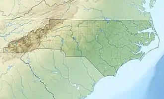
Johnson Creek is a 10.71 mi (17.24 km) long 2nd order tributary to the Ararat River in Surry County, North Carolina.
Variant names
According to the Geographic Names Information System, it has also been known historically as:[1]
- Johnstons Creek
Course
Johnson Creek rises on the Grassy Creek divide at Orchard Gap in Carroll County, Virginia. Johnson Creek then flows south-southeast into Patrick County, Virginia and continues to Surry County, North Carolina to join the Ararat River about 0.1 miles southwest of Sulphur Springs.[2]
Watershed
Johnson Creek drains 18.60 square miles (48.2 km2) of area, receives about 50.0 in/year of precipitation, has a wetness index of 305.34, and is about 71% forested.[4]
See also
References
- 1 2 3 "GNIS Detail - Johnson Creek". geonames.usgs.gov. US Geological Survey. Retrieved 19 September 2020.
- 1 2 3 "East Fork Johnson Creek Topo Map in Patrick". TopoZone. Locality, LLC. Retrieved 19 September 2020.
- ↑ "ArcGIS Web Application". epa.maps.arcgis.com. US EPA. Retrieved 19 September 2020.
- 1 2 3 "Johnson Creek Watershed Report". US EPA Geoviewer. US EPA. Retrieved 19 September 2020.
This article is issued from Wikipedia. The text is licensed under Creative Commons - Attribution - Sharealike. Additional terms may apply for the media files.