Kato Agios Ioannis
Κάτω Άγιος Ιωάννης | |
|---|---|
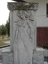 A sculpture in Kato Agios Ioannis | |
 Kato Agios Ioannis | |
| Coordinates: 40°19.5′N 22°32′E / 40.3250°N 22.533°E | |
| Country | Greece |
| Administrative region | Central Macedonia |
| Regional unit | Pieria |
| Municipality | Katerini |
| Municipal unit | Korinos |
| Highest elevation | 90 m (300 ft) |
| Lowest elevation | 55 m (180 ft) |
| Community | |
| • Population | 603 (2011) |
| Time zone | UTC+2 (EET) |
| • Summer (DST) | UTC+3 (EEST) |
| Postal code | 601 00 |
| Area code(s) | +30-2351-xxx-xxx |
| Vehicle registration | KN |
Kato Agios Ioannis (Greek: Κάτω Άγιος Ιωάννης) is a village and a community of the Katerini municipality.[2] Before the 2011 local government reform it was part of the municipality of Korinos, of which it was a municipal district.[2] The 2011 census recorded 603 inhabitants in the village.[1]
References
- 1 2 "Απογραφή Πληθυσμού - Κατοικιών 2011. ΜΟΝΙΜΟΣ Πληθυσμός" (in Greek). Hellenic Statistical Authority.
- 1 2 "ΦΕΚ B 1292/2010, Kallikratis reform municipalities" (in Greek). Government Gazette.
See also
This article is issued from Wikipedia. The text is licensed under Creative Commons - Attribution - Sharealike. Additional terms may apply for the media files.