Kemence | |
|---|---|
 Flag  Coat of arms | |
 Kemence Location of Kemence in Hungary | |
| Coordinates: 48°01′19″N 18°53′42″E / 48.02181°N 18.89503°E | |
| Country | Hungary |
| Region | Central Hungary |
| County | Pest |
| Subregion | Szobi |
| Rank | Village |
| Area | |
| • Total | 42.75 km2 (16.51 sq mi) |
| Population (1 January 2008)[2] | |
| • Total | 1,036 |
| • Density | 24/km2 (63/sq mi) |
| Time zone | UTC+1 (CET) |
| • Summer (DST) | UTC+2 (CEST) |
| Postal code | 2638 |
| Area code | +36 27 |
| KSH code | 22345[1] |
| Website | http://www.kemence.hu |
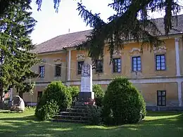
Former county hall in Kemence
References
- 1 2 Kemence at the Hungarian Central Statistical Office (Hungarian).
- ↑ Kemence at the Hungarian Central Statistical Office (Hungarian). 1 January 2008
Wikimedia Commons has media related to Kemence.
This article is issued from Wikipedia. The text is licensed under Creative Commons - Attribution - Sharealike. Additional terms may apply for the media files.