Kotwali | |
|---|---|
town | |
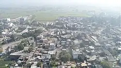 kotwali photo click by dron camera | |
 Kotwali  Kotwali | |
| Coordinates: 29°25′51″N 78°21′25″E / 29.43083°N 78.35694°E | |
| Country | |
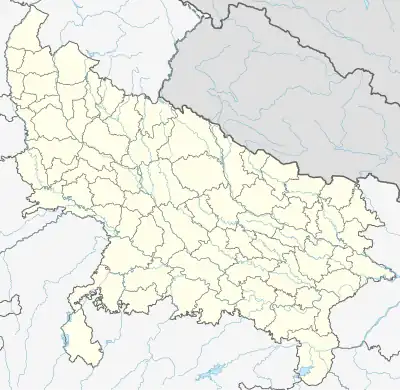
| District | Bijnor |
| Established | 1790 |
| Founded by | sher e kotwal |
| Government | |
| • Type | Gram Panchayat Pradhan |
| • Body | Gram panchayat |
| Area | |
| • Total | 12,000 ha (30,000 acres) |
| Population (2011) | |
| • Total | 15,300 |
| • Density | 130/km2 (330/sq mi) |
| Languages | |
| • Official | Hindi , Urdu |
| Time zone | UTC+5:30 (IST) |
| Vehicle registration | UP 20 |
| clean kotwali sundar kotwali | |
Kotwali Dehat is a large block and village[1] in the Bijnor district and Tehsil Nagina of the Indian state of Uttar Pradesh.
It is 7 kilometers from Nagina, 23 kilometers from Najibabad, 25 kilometers from Dhampur, and 8 kilometers from Nehtour.[2][3][4][5]
References
- ↑ "Full list of villages of Kotwali block in Bijnor district". www.viewvillage.in. Retrieved 7 June 2023.
- ↑ "Kotwali Census Town City Population Census 2011-2023 | Uttar Pradesh". www.census2011.co.in. Retrieved 7 June 2023.
- ↑ [h "K"]. Retrieved 7 June 2023.
{{cite web}}: Check|url=value (help) - ↑ "Population finder | Government of India". censusindia.gov.in. Retrieved 7 June 2023.
- ↑ "Village - Madiwala, Post - Kotwali Dehat, Distt - Bijnor Pin Code: Village - Madiwala, Post - Kotwali Dehat, Distt - Bijnor, Najibabad, Bijnor, Bijnor Post Office Code & Address with Map". codepin.in. Retrieved 7 June 2023.
- ↑ "Table C-01 Population by Religion: Uttar Pradesh". censusindia.gov.in. Registrar General and Census Commissioner of India. 2011.
This article is issued from Wikipedia. The text is licensed under Creative Commons - Attribution - Sharealike. Additional terms may apply for the media files.