| Kyushu Mountains | |
|---|---|
.jpg.webp) View of Kyushu Mountains with Mount Kujū.[1] | |
| Highest point | |
| Peak | Mount Sobo |
| Elevation | 1,756 m (5,761 ft) |
| Naming | |
| Native name | |
| Geography | |
 Kyushu Mountains Location of Kyushu Mountains in Japan | |
| Country | Japan |
| Region | Kantō region |
| Range coordinates | 32°49′N 131°23′E / 32.817°N 131.383°E |
| Parent range | Kantō Range |
Kyushu Mountains (Japanese: 九州山地) is a mountain range that runs from northeast to southwest in central Kyushu.[2]
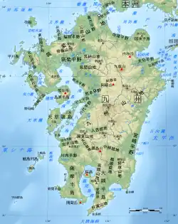
Geofeatures map of Kyushu
The highest peak of the mountain range is Mount Sobo.[3][4]
References
- ↑ Kuju Mountains japan-guide.com
- ↑ 第2版, 日本大百科全書(ニッポニカ),精選版 日本国語大辞典,ブリタニカ国際大百科事典 小項目事典,百科事典マイペディア,デジタル大辞泉,世界大百科事典. "九州山地とは". コトバンク (in Japanese). Retrieved 2021-05-24.
{{cite web}}: CS1 maint: multiple names: authors list (link) CS1 maint: numeric names: authors list (link) - ↑ 第2版, 日本大百科全書(ニッポニカ),事典・日本の観光資源,ブリタニカ国際大百科事典 小項目事典,百科事典マイペディア,精選版 日本国語大辞典,デジタル大辞泉,世界大百科事典. "祖母山とは". コトバンク (in Japanese). Retrieved 2021-05-24.
{{cite web}}: CS1 maint: multiple names: authors list (link) CS1 maint: numeric names: authors list (link) - ↑ "きゅうしゅうさんち【九州山地】 | き | 辞典". 学研キッズネット (in Japanese). Retrieved 2021-05-24.
This article is issued from Wikipedia. The text is licensed under Creative Commons - Attribution - Sharealike. Additional terms may apply for the media files.