Léalvillers | |
|---|---|
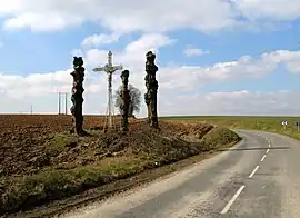 The cross in Léalvillers | |
Location of Léalvillers | |
 Léalvillers  Léalvillers | |
| Coordinates: 50°03′54″N 2°30′40″E / 50.065°N 2.5111°E | |
| Country | France |
| Region | Hauts-de-France |
| Department | Somme |
| Arrondissement | Péronne |
| Canton | Albert |
| Intercommunality | CC Pays du Coquelicot |
| Government | |
| • Mayor (2020–2026) | Véronique Cozette[1] |
| Area 1 | 2.23 km2 (0.86 sq mi) |
| Population | 161 |
| • Density | 72/km2 (190/sq mi) |
| Time zone | UTC+01:00 (CET) |
| • Summer (DST) | UTC+02:00 (CEST) |
| INSEE/Postal code | 80470 /80560 |
| Elevation | 116–157 m (381–515 ft) (avg. 142 m or 466 ft) |
| 1 French Land Register data, which excludes lakes, ponds, glaciers > 1 km2 (0.386 sq mi or 247 acres) and river estuaries. | |
Léalvillers is a commune in the Somme département in the Hauts-de-France region of France.[3]
Geography
Situated at the junction of the D114 and D31 roads, some 20 miles (32 km) northeast of Amiens.
Population
| Year | Pop. | ±% p.a. |
|---|---|---|
| 1968 | 161 | — |
| 1975 | 158 | −0.27% |
| 1982 | 182 | +2.04% |
| 1990 | 183 | +0.07% |
| 1999 | 166 | −1.08% |
| 2007 | 180 | +1.02% |
| 2012 | 174 | −0.68% |
| 2017 | 167 | −0.82% |
| Source: INSEE[4] | ||
See also
References
- ↑ "Répertoire national des élus: les maires". data.gouv.fr, Plateforme ouverte des données publiques françaises (in French). 9 August 2021.
- ↑ "Populations légales 2021". The National Institute of Statistics and Economic Studies. 28 December 2023.
- ↑ Commune de Léalvillers (80470), INSEE
- ↑ Population en historique depuis 1968, INSEE
External links
Wikimedia Commons has media related to Léalvillers.
- Léalvillers on the Quid website (in French)
This article is issued from Wikipedia. The text is licensed under Creative Commons - Attribution - Sharealike. Additional terms may apply for the media files.