La Chapelle-Haute-Grue | |
|---|---|
Part of Val-de-Vie | |
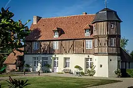 Manoir of Caudemone | |
Location of La Chapelle-Haute-Grue | |
 La Chapelle-Haute-Grue  La Chapelle-Haute-Grue | |
| Coordinates: 48°58′03″N 0°08′54″E / 48.9675°N 0.1483°E | |
| Country | France |
| Region | Normandy |
| Department | Calvados |
| Arrondissement | Lisieux |
| Canton | Livarot-Pays-d'Auge |
| Commune | Val-de-Vie |
| Area 1 | 2.92 km2 (1.13 sq mi) |
| Population (2019)[1] | 75 |
| • Density | 26/km2 (67/sq mi) |
| Time zone | UTC+01:00 (CET) |
| • Summer (DST) | UTC+02:00 (CEST) |
| Postal code | 14140 |
| Elevation | 70–192 m (230–630 ft) (avg. 90 m or 300 ft) |
| 1 French Land Register data, which excludes lakes, ponds, glaciers > 1 km2 (0.386 sq mi or 247 acres) and river estuaries. | |
La Chapelle-Haute-Grue (French pronunciation: [la ʃapɛl ot ɡʁy] ⓘ) is a former commune in the Calvados department in the Normandy region in northwestern France. On 1 January 2016, it was merged into the new commune of Val-de-Vie.[2]
Population
| Year | Pop. | ±% |
|---|---|---|
| 1962 | 80 | — |
| 1968 | 60 | −25.0% |
| 1975 | 40 | −33.3% |
| 1982 | 41 | +2.5% |
| 1990 | 38 | −7.3% |
| 1999 | 30 | −21.1% |
| 2008 | 45 | +50.0% |
See also
References
- ↑ Téléchargement du fichier d'ensemble des populations légales en 2019, INSEE
- ↑ Arrêté préfectoral Archived 2022-04-19 at the Wayback Machine 22 December 2015 (in French)
Wikimedia Commons has media related to La Chapelle-Haute-Grue.
This article is issued from Wikipedia. The text is licensed under Creative Commons - Attribution - Sharealike. Additional terms may apply for the media files.