La Chapelle-Saint-Sauveur | |
|---|---|
Part of Loireauxence | |
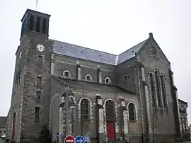 The church of the Transfiguration, in La Chapelle-Saint-Sauveur | |
.svg.png.webp) Coat of arms | |
Location of La Chapelle-Saint-Sauveur | |
 La Chapelle-Saint-Sauveur 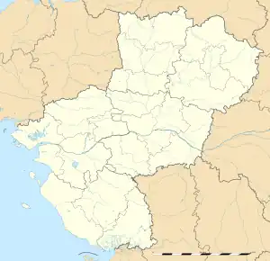 La Chapelle-Saint-Sauveur | |
| Coordinates: 47°26′31″N 0°59′06″W / 47.4419°N 0.985°W | |
| Country | France |
| Region | Pays de la Loire |
| Department | Loire-Atlantique |
| Arrondissement | Châteaubriant-Ancenis |
| Canton | Ancenis-Saint-Géréon |
| Commune | Loireauxence |
| Area 1 | 18.7 km2 (7.2 sq mi) |
| Population (2019)[1] | 815 |
| • Density | 44/km2 (110/sq mi) |
| Demonym(s) | Capellovalsiennes, Capellovalsiens Chapelloises, Chapellois |
| Time zone | UTC+01:00 (CET) |
| • Summer (DST) | UTC+02:00 (CEST) |
| Postal code | 44370 |
| Elevation | 32–76 m (105–249 ft) |
| Website | lachapellesaintsauveur44.fr |
| 1 French Land Register data, which excludes lakes, ponds, glaciers > 1 km2 (0.386 sq mi or 247 acres) and river estuaries. | |
La Chapelle-Saint-Sauveur (French pronunciation: [la ʃapɛl sɛ̃ sovœʁ]; Breton: Chapel-ar-Salver) is a former commune in the Loire-Atlantique department in western France. On 1 January 2016, it was merged into the new commune of Loireauxence.[2]
See also
Wikimedia Commons has media related to La Chapelle-Saint-Sauveur (Loire-Atlantique).
References
This article is issued from Wikipedia. The text is licensed under Creative Commons - Attribution - Sharealike. Additional terms may apply for the media files.