| La Miranda | |
|---|---|
 | |
| Highest point | |
| Elevation | 918 m (3,012 ft) |
| Prominence | 289 m (948 ft) |
| Isolation | 1.91 km (1.19 mi) to Mola de Colldejou |
| Listing | Mountains in Catalonia |
| Geography | |
| Location | Baix Camp & Ribera d'Ebre, Catalonia |
| Parent range | Serra de Llaberia |
| Geology | |
| Mountain type | Karstic |
| Climbing | |
| First ascent | Unknown |
| Easiest route | From Colldejou |
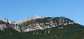
La Miranda is a mountain of the Catalan Pre-Coastal Range in the autonomous community of Catalonia in Spain. It has an elevation of 918 metres above sea level.[1]
It is the second-highest summit of the Serra de Llaberia range. There is a weather radar at the top.
References
- ↑ "Mapa Topogràfic de Catalunya". Institut Cartogràfic de Catalunya. Retrieved May 22, 2010..
This article is issued from Wikipedia. The text is licensed under Creative Commons - Attribution - Sharealike. Additional terms may apply for the media files.