| Laguna Lake | |
|---|---|
| Lago de la Laguna (Spanish) | |
 | |
 Laguna Lake  Laguna Lake | |
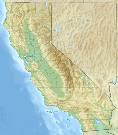
| Location | Sonoma and Marin counties, California |
| Coordinates | 38°12′52″N 122°44′52″W / 38.214363°N 122.747767°W |
| Type | intermittent lake |
| Primary outflows | Chileno Creek |
| Basin countries | United States |
| Max. length | 2 miles (3 km)[1] |
| Max. width | 0.5 miles (1 km)[1] |
| Surface area | 200 acres (81 ha) |
| Surface elevation | 226 ft (69 m)[2] |
| Settlements | Petaluma, California |
| References | [2] |
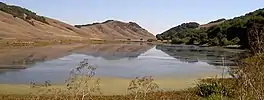
Laguna Lake is a shallow natural lake at the head of the Chileno Valley. It retains some water year round.[3] The 200 acres (81 ha) lake is 0.5 miles (1 km) wide and 2 miles (3 km) long, straddling the Sonoma-Marin county line in northern California, United States.[1] It is the source of Chileno Creek which flows 10 kilometres (6.2 mi) west to Walker Creek.[4]
It was included in the Rancho Laguna de San Antonio Mexican land grant,[5] which was given to Bartolomé Bojorquez in 1845.[6]
Laguna Lake is used extensively for migrating and breeding waterfowl and Agriculture. agr.[3]
See also
References
- 1 2 3 Durham, David L. (1998). California's Geographic Names: A Gazetteer of Historic and Modern Names of the State. Quill Driver Books. p. 650. ISBN 1-884995-14-4.
- 1 2 U.S. Geological Survey Geographic Names Information System: Laguna Lake
- 1 2 "Tomales Bay Watershed - History and Habitat". Marin County Watershed Program. Retrieved December 26, 2017.
- ↑ "Chileno Creek". Geographic Names Information System. United States Geological Survey, United States Department of the Interior.
- ↑ U.S. Geological Survey Geographic Names Information System: Laguna De San Antonio
- ↑ "Plat of the Rancho Laguna de San Antonio". Retrieved 2009-02-03.
This article is issued from Wikipedia. The text is licensed under Creative Commons - Attribution - Sharealike. Additional terms may apply for the media files.