Langenbernsdorf | |
|---|---|
 | |
Location of Langenbernsdorf within Zwickau district 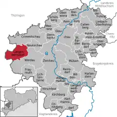 | |
 Langenbernsdorf 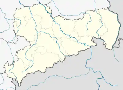 Langenbernsdorf | |
| Coordinates: 50°45′N 12°18′E / 50.750°N 12.300°E | |
| Country | Germany |
| State | Saxony |
| District | Zwickau |
| Subdivisions | 4 |
| Government | |
| • Mayor (2019–26) | Frank Rose[1] |
| Area | |
| • Total | 36.37 km2 (14.04 sq mi) |
| Elevation | 280 m (920 ft) |
| Population (2021-12-31)[2] | |
| • Total | 3,536 |
| • Density | 97/km2 (250/sq mi) |
| Time zone | UTC+01:00 (CET) |
| • Summer (DST) | UTC+02:00 (CEST) |
| Postal codes | 08428 |
| Dialling codes | 03761 |
| Vehicle registration | Z |
| Website | www.langenbernsdorf.de |
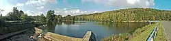
Langenbernsdorf is a village in the district of Zwickau in the Free State of Saxony.
Geography
To the north of Langenbernsdorf is a wood called the Werdauer Wald.
Neighboring municipalities
Adjacent municipalities in the district of Zwickau include:
Teichwolframsdorf in Thuringia is also adjacent to Langenbernsdorf.
Municipality subdivisions
The municipality includes the following subdivisions:
- Langenbernsdorf
- Niederalbertsdorf
- Stöcken
- Trünzig
History
Langenbernsdorf was founded in 1257 and was named "Bernztorff".[3]
References
- The information in this article is based on and/or translated from its German equivalent.
- ↑ Wahlergebnisse 2019, Freistaat Sachsen, accessed 10 July 2021.
- ↑ "Bevölkerung des Freistaates Sachsen nach Gemeinden am 31. Dezember 2021" (XLS) (in German). Statistisches Landesamt des Freistaates Sachsen. 2022.
- ↑ The official homepage of the village langenbernsdorf - The History Archived 2007-10-09 at the Wayback Machine
External links
This article is issued from Wikipedia. The text is licensed under Creative Commons - Attribution - Sharealike. Additional terms may apply for the media files.